Garland County Map, Arkansas

Garland County Map, Arkansas shows a visual representation of the county's location. It is located in the central-western part of the state. Garland County, Arkansas is known for its natural hot springs and Hot Springs National Park. The map also shows the county seat Hot Springs.


Garland County Map showing the location of Garland County in Arkansas.


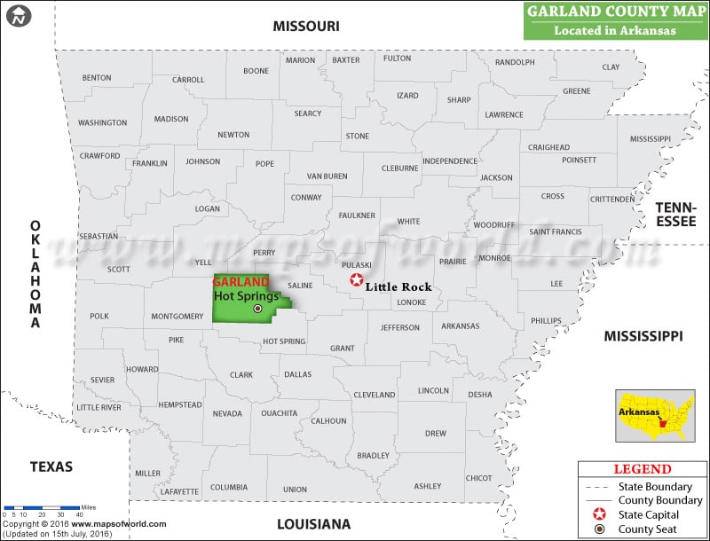
Map of Garland County, Arkansas

You can also create a a personalized map of Garland County, simply click the ‘Customize’ button above the map. It will redirect you to our digital store where you can create a customize map of Garland County as per your needs or liking. Also, explore our comprehensive Arkansas County Map to discover more about the state’s counties.

Facts about Garland County

County Garland
State Arkansas
Country USA
Population – 2021 99.380


Related posts

Stone County Map, Arkansas

Union County Map, Arkansas

Van Buren County Map, Arkansas

This website uses cookies to improve your experience. We'll assume you're ok with this, but you can opt-out if you wish. Read More