Railroad in Arkansas
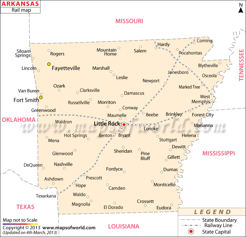
Arkansas Rail Map shows the wide-reaching network of trains which connect the state’s various cities. Amtrak is one of the prime railway service providers of Arkansas and their trains run through various railway stations such as Walnut Ridge, Malvern and Little Rock.
The Amtrak-Texas rail Eagle route passes through such locations as Arkansas, San Antonio, Missouri, Chicago, Texas and Illinois. Apart from major junctions, the map of Arkansas railways also highlights smaller railway stations. The huge number of cities that are intersected by the rail routes of Arkansas proves the well-developed state of this particular mode of transportation. Some of the prime areas where the railway network of Arkansas is available include Little Rock, Brinkley, Hardy, Ola, Arkadelphia, Benton, Waldron, Forest City, and many others.
The state railways of Arkansas undertake a wide range of projects to further develop the network sphere. Apart from local inhabitants of Arkansas, the railway services are also used by the tourists. In order to provide an unhindered array of train services, the railways of Arkansas operate throughout the year. Arkansas state map is a vital indicator of the various railway tracks that intersect the cities and towns of the state.

 Wall Maps