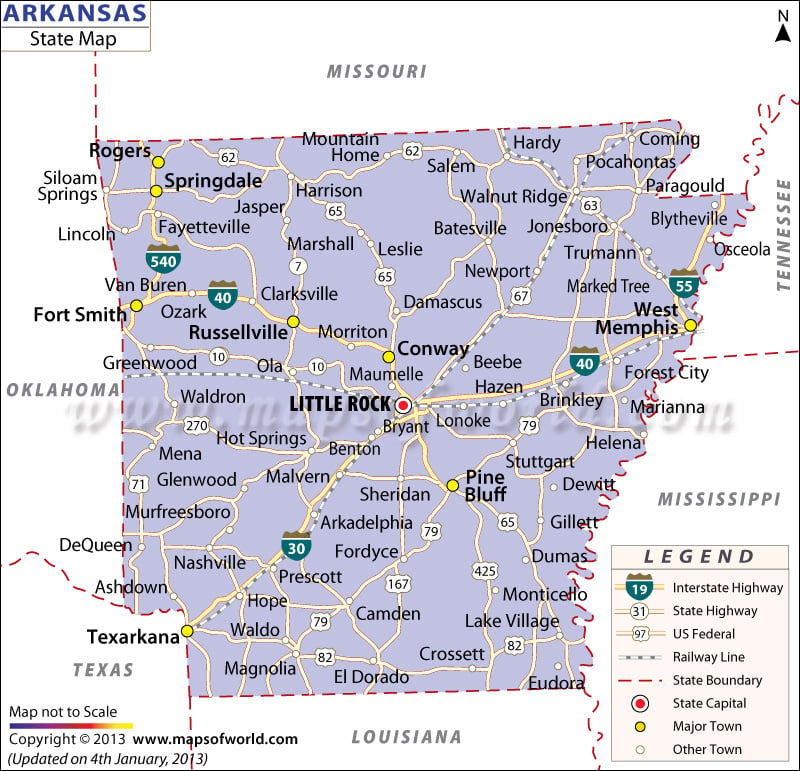
State Map of Arkansas
The State Map of Arkansas provides a detailed insight into the entire geography of the state. Communication networks including road, rail and airways, historical places of interest, the state capital and major towns are also highlighted in the map. Little Rock is the capital city of Arkansas. Being the 25th state of America, Arkansas houses a number of cities, towns and villages.
Some prominent cities are White Hall, Warren, Carlisle, and Bigelow. The 1,450-mile long Arkansas River is the major natural stream of the state. Officially called “The Natural State,” Arkansas is governed by a bicameral legislature. Among the many state symbols, the mockingbird is recognized as the state bird.
There are several tourist places in and around Arkansas like Hot Springs Mountain, national parks, museums, and lakes. Woodworking, rice processing, fishing, animal husbandry, forestry, agriculture, and mining are some of the major industries of the state.
The transportation network of Arkansas is quite developed. Roads, railways, steamboats and airways offer comfortable and efficient communication services to the people of Arkansas. Tourists visiting there for the first time find the Arkansas State map quite useful as it contains a range of relevant and comprehensive information.

 Wall Maps