3.6K
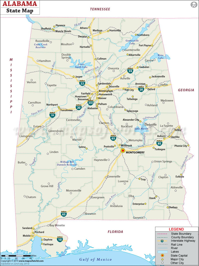
Located in the southeastern region of the United States, Alabama is the 30th most extensive state of the country. Alabama was admitted to the union in 1819 as the 22nd state. The capital of Alabama is based in Montgomery, while its largest city is Birmingham.
Facts about Alabama
- The map of Alabama depicts the state and county boundaries.
- The state capital, which is marked with a red dot, is clearly identifiable.
- The major cities of the state are marked with a yellow dot, while other cities with a white one.
- The Interstate Highway and the Rail Line are clearly shown on the map.
- The lakes and rivers are shown on the map and are easily identifiable by the user.
- The user will also get an idea of the neighboring states of Alabama. Tennessee is shown in the north, while Georgia is marked in the east. Mississippi and Florida are shown in the west and the south respectively.
 Wall Maps