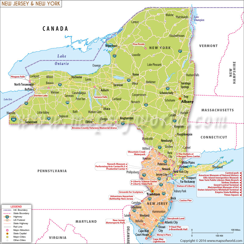
| Joined in Union | July 26, 1788 | December 18, 1787 |
| Joining Sequence | 11th | 3rd |
| Nick name | The Empire State | The Garden State |
| State song | "I Love New York" | No State Song (state song. I'm From New Jersey is incorrectly listed on many websites) |
| Area | 54,555 sq mi (141,300 km2) | 8,722.58 sq mi (22,591.38 km2) |
| Capital | Albany | Trenton |
| Largest City | New York City | Newark |
| Population | 19,795,791 (2015 est) | 8,958,013 (2015 est) |
| Population density | 416.42/sq mi (159/km2) | 1210.10/sq mi (467/km2) |
| Counties | 62 | 21 |
| Cities | 62 Cities | 52 Cities |
| Lat Long | 43.2994º N, 74.2179º W | 40.0583º N, 74.4057º W |
| Time Zone | Eastern: UTC -5/-4 | Eastern: UTC -5/-4 |
| Official site | www.ny.gov | www.nj.gov |
| Abbreviations | NY | NJ, N.J. |
| Interstate highways | There are 32 Interstate Highways | I-76, I-78, I-80, I-95, I-195, I-278, I-280, I-287, I-295, I-495, I-676, I-695, I-895 |
| Rivers | Hudson River, Mohawk River, Allegheny River | Manasquan River, Maurice River, Mullica, Passaic, Rahway, Raritan, Musconetcong, Hudson and Delaware rivers |
| Mountains | Adirondack Mountains, Catskill Mountains, Appalachian Mountains. | Sunrise Mountain, Catfish Mountain, Rattlesnake Mountain, Bearfort Mountain, Bearfort Mountain North, Wawayanda Mountain, Wawayanda Mountain, Blue Mountain, Bowling Green Mountain, Buckabear Mountain, Bird Mountain, Lookout Mountain, County House Mountain, Rocky Mountain etc. |
| Highest Point | Mount Marcy 5,344 ft (1,629 m) | High Point- 1,803 ft (549.6 m) |
| Lowest Point | Atlantic Ocean | Atlantic Ocean |


