Some 12 miles of Mammoth Cave are open to the public, with tour routes offering a diversity of experiences, from strolls that focus on spectacular formations to more challenging walks that center on cave history. For the latter, visitors don protective gear and crawl their way through tight passageways.
Mammoth Cave’s vast rooms and winding tunnels exist today because of a coincidence of geologic events. More than 300 million years ago, what is now central Kentucky was covered by a shallow tropical sea, where organic matter formed layers of limestone hundreds of feet thick. Fifty million years later, a river system deposited sand and mud that transformed to sandstone and shale.
Over time, underground rivers cut passages through the relatively soft limestone. As the water level dropped, the cave rivers sank deeper, exposing higher channels as dry caverns. Meanwhile, the harder overlying sandstone layer served as protection for the cave system, preventing it from eroding and collapsing into sinkholes and valleys.
Cave formations are created when water seeps through limestone, dissolving minerals and redepositing them on passage ceilings, walls, and floors. Mammoth Cave’s sandstone “roof” keeps this process from happening in much of the cave, so visitors who want to enjoy stalactites, stalagmites, columns, draperies, and other subterranean features should study tour descriptions and choose from the cave’s scenic routes.
There’s more to the national park than just the cave, of course. Mammoth Cave’s 83 square miles encompass lush forests that teem with wildlife, as well as 25 miles of the Green River, one of North America’s most biologically diverse waterways. Biking, hiking, horseback riding, boating, and fishing are active options—before or after experiencing the world belowground.
How to Visit
Every visit should include at least one cave tour and, if you have more time, exploration above ground. Read descriptions on the park website or speak to a ranger at the visitor center when you arrive to determine which tours (fee) best match your interests and level of fitness. Try to make advance reservations for tours (recreation.gov; 877-444- 6777), especially for summer and weekend visits.
Wear sturdy shoes with nonslip soles and dress for the cave temperature, in the mid-50s F year-round. Tours are led by park rangers. Note that there are items that are prohibited on all tours, including camera tripods, large backpacks, and strollers.
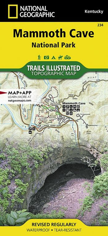
You won’t really know Mammoth Cave National Park without spending some time on its aboveground trails. As is the case with the cave tours, routes range from short and easy paths to longer trails that are suitable for backpackers.
Also consider a canoe or kayak trip on the Green River or a horseback ride through the park; local independent outfitters offer a variety of options for boating as well as horseback riding.
Useful Information
How to get there
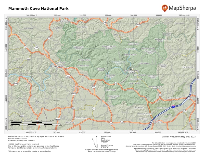
From Louisville, KY (about 90 miles north), take I-65 south to Cave City, then go west on Ky. 70. From Nashville, TN (about 90 miles north), take I-65 north to Park City and go north on Tenn. 255.
When to go
The cave is open all year. Tours are offered more often in summer than during the rest of the year. All activities are best Memorial Day through Labor Day.
Visitor Centers
The park visitor center is open daily, year-round.
Headquarters
1 Mammoth Cave Parkway Mammoth Cave, KY 42259 nps.gov/maca 270-758-2180
Camping
Of the park’s three campgrounds, two take reservations: Mammoth Cave (111 sites) and Maple Springs (7 sites). Houchin Ferry (12 sites) operates on a first-come, first-served basis. Backcountry camping requires a free permit from the Mammoth Cave campground
Lodging
Mammoth Cave Lodge (mammoth cave lodge.com; 844-760-2283) is a concessioner-operated facility near the visitor center. Several hotels are also located in nearby Cave City (cavecity .com; 270-773-8833).
US National Parks Map
About the Guide


