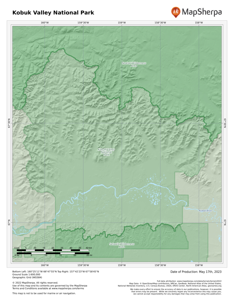
Just above the Arctic Circle, Kobuk Valley is nowhere near the beaten track. Over the course of a busy year, the park will see fewer visitors than Yellowstone’s Old Faithful gets in a single hour on a rainy summer Sunday. Most years, Kobuk Valley is in the running as the least visited national park in the entire system.
Seasonally populating the park is the largest caribou herd in the United States. The majestic animals pass through twice on their annual migration, heading north in the spring and south in the fall.
More than a hundred species of birds use the park as a flyway and nesting ground. The very remoteness of the park—the very reason so few people come here—is what makes Kobuk Valley one of the most vital areas protected by the National Park Service. Here, it’s never been anything but business as usual for nature.
Kobuk Valley is a transition zone, with Gates of the Arctic National Park to the east, the Bering Sea to the west, Noatak National Preserve to the north, and the Selawik National Wildlife Refuge to the south. Within Kobuk Valley, the great birch and spruce forests of central Alaska give way to the tundra of the Arctic.
In general, the farther north you go, the shorter the trees are, having a hard time surviving the cold soil to send roots down past the permafrost. A very tall tree in the Arctic is five or six feet high, and those are usually along riverbanks, where the water helps growth and adds to the visual landscape.
The park does not have the high peaks of the central Brooks Range. The highest mountain in the park is Mount Angayukaqsraq, just 4,760 feet high. Still, the mountains are many and imposing, with the Baird Mountains (a subrange of the Brooks) practically cutting the park in half.
How to Visit
This is one of the most remote areas of the United States, a place where those familiar with Arctic travel fare best. Some adventurers float in, paddling the Kobuk River (often frozen) or the even more remote Salmon River (only for the extremely hardy; you must carry a pack raft up to the headwaters to access the river).
Use the banks as base camps for hiking and the rivers themselves as roads. Plan well, dress for changing weather, and expect a bear around nearly every corner. Welcome to Alaska’s Garden of Eden.
Information
How to get there
The only way in is by plane. Alaska Airlines (alaskaair.com) flies from Anchorage to the park’s city of Kotzebue. The national park website has a list of air taxis that have a permit to fly into the park. Visitors who bring collapsible boats can float from Ambler to Kiana.
When to go
The park is open year-round, but only very experienced wilderness adventurers should consider visiting outside summer months. Any time of year, expect sudden weather shifts. Snowmobile access is permitted in winter.
Visitor Center
The park’s visitor center (907-422- 3890), open year-round, is the Northwest Heritage Center, in Kotzebue.
Headquarters
P.O. Box 1029 171 Third Avenue Kotzebue, AK 99752 nps.gov/kova 907-442-3890
Camping
There are no developed campgrounds. With a few exceptions, you can camp anywhere in the park. No permit is needed, but for the sake of safety you should register your itinerary with park officials. Observe all bear precautions, and take enough extra food to allow for being weathered-in for a few days— not uncommon.
Lodging
The nearest lodging is in Kotzebue (cityofkotzebue.com).
US National Parks Map
About the Guide


