Maps of World
Current, Credible, Consistent
World Map / US Map / Highways / US Route 53 Map

US Route 53 Map

Print
US Route 53 Map
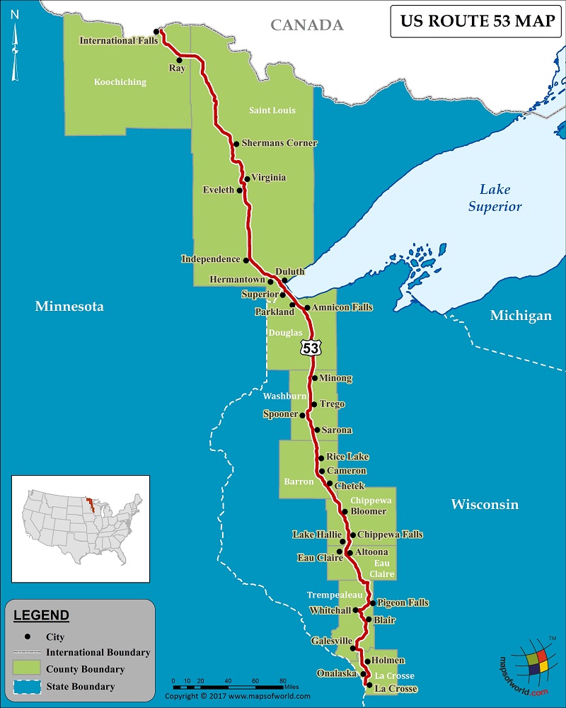
Description : US route 53 map showing the path of highway 53 with states and cities covered. Disclaimer
Close

Disclaimer : All efforts have been made to make this image accurate. However MapSherpa, Inc, its directors and employees do not own any responsibility for the correctness or authenticity of the same.


US Route 53


US Route 53 is a significant route of the US Numbered Highway System, and is a north-south US highway. Comprising a total length of 403 miles, US Route 53, traverses from La Crosse, Wisconsin to International Falls, Minnesota. Route 53 connects just two states – Wisconsin and Minnesota. Some cities that the route passes through are Independence, Virginia, Eveleth, Hermantown, Minong, Sarona, Rice Lake, and others.

Route 53 serves as a link between I-94 in Eau Claire, Wisconsin, and the port city of Duluth, Minnesota. The section of the route in Wisconsin that runs between Eau Claire and the city of Superior, is a four-lane divided highway. The Minnesota portion of 53 is known as the ‘Voyageurs Highway.’ Some of the major junctions that connect US Route 53 are I-90, I-94, I-35, MN 33, and US 71.

PB05.08.2017

Last Updated Date: August 5th, 2017


"By clicking OK or by using this Website, you consent to the use of cookies. Your personal data will be governed by Mapsofworld Privacy Policy and Terms."
OK


For further info please get in touch with us at
mail  [email protected]