US Interstate 37 highway Map
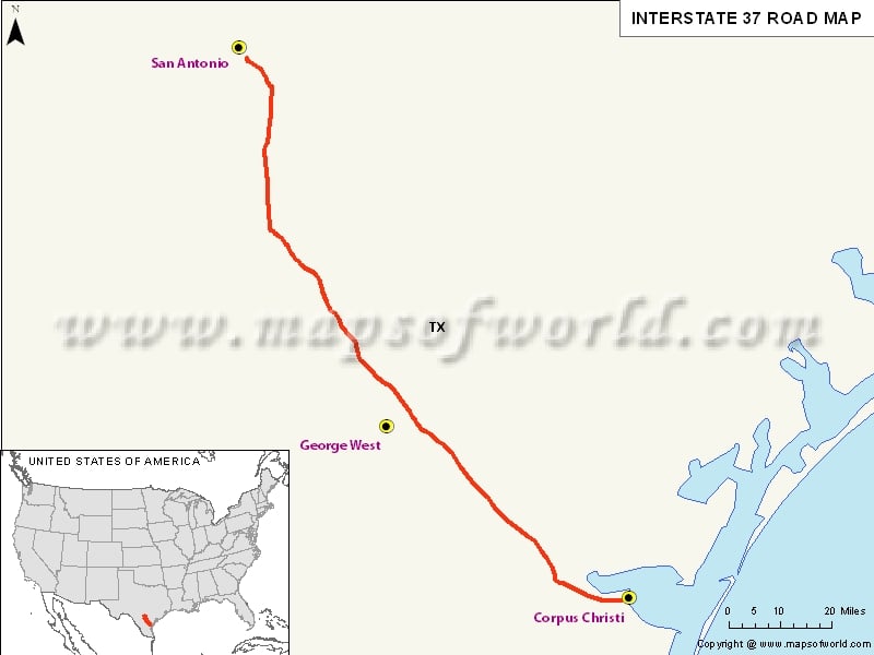
Interstate 37, popularly abbreviated as I-37 is a 143.0 mile/230.1 km Interstate Highway that’s located within the US state of Texas. It was first designated in 1950 as the route between Corpus Christi and San Antonio. It was in the 1960s that construction began in the urban areas of Corpus Christi and San Antonio. Hence, the construction of Interstate 37 led to removal of SH 9 from the State Highway System.
Extent of I-37 Highway
Interstate 37 stretches from Corpus Christi at US 181 and SH 35 towards the north to San Antonio where the Interstate 37 ends at Interstate 35. This freeway also continues as US 281 to the northern San Antonio, serving as a major freeway.While in Corpus Christi, Interstate 37 offers access to downtown area, in San Antonio, it provides access to Downtown, Brooks City-Base, the Alamodome, the Tower of the Americas, the River Walk, the Alamo and the by extension via US 281.
States and cities along I-37 Highway
- Texas: Corpus Christi, San Antonio
Restaurants along Interstate-37 Highway
Here is a list of few great restaurants along Interstate-37 Highway:
- Boudro’s on the River Walk
- Oro Restaurant
- Las Canarias
- Rosario’s
- Neptune’s Seafood House
Attractions along I-37 Highway
Some of the renowned tourist attractions along I-37 Highway include:
- Mission Concepcion
- River Walk
- The Alamo
- Espada Dam
- Alice Knight
Route of Interstate Highway No.37 |
| State | Entry Point | Exit Point | Length |
|---|---|---|---|
| Texas | Corpus Christi, TX | San Antonio, TX | 143.00 mi (230.14 km) |
| Total Length | 143.00 mi (230.14 km) |
Last Updated Date: April 15, 2017


