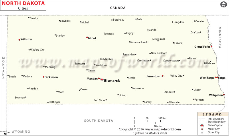
North Dakota City Maps

In the Midwestern and the northern regions of the United States, North Dakota is the 19th largest state by area and the 47th most populous. Fargo is the largest city by population. As of 2016, the city had an estimated population of 120,762 people. The county seat of Cass County, Fargo, accounts for approximately 15 percent of the population of North Dakota. Bismarck, the state capital, is the second most populous city. Founded on May 14, 1872, Bismarck had a population of roughly 72,417 inhabitants. Cities that have a population of more than 20,000 people are Grand Forks, Minot, West Fargo, Williston, Dickinson, and Mandan. Ruso, in McLean County, is the least populous. As of 2016, only four people lived in Ruso.
The state has 53 counties. Founded in 1871, Fargo is the most populous city in the state. The state capital is Bismarck, and the North Dakota State Capitol is the tallest building in the state. Grand Forks is the third largest city in the Red River Valley. Known as ‘Magic City,’ Minot hosts the North Dakota State Fair in July. Jamestown features a 26-ft tall sculpture named as World’s Largest Buffalo Monument.
Williston, Dickinson, and Mandan are other notable cities in North Dakota.
Getting In and Around
Hector International Airport (FAR) in Fargo is the busiest airport in the state.
Amtrak operates Empire Builder route through the state.
I-29 and I-94 are two primary interstate highways in North Dakota.
List of Cities in North Dakota |
|---|
|
 Wall Maps