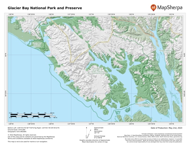
George Vancouver, a British naval officer, sailed this way in 1794 to map the region. There was no bay then, just a 5-mile inlet; all around were mountains and glaciers.
Before Vancouver’s explorations, local Tlingit people, who had called the area home for centuries, were forced to flee 20 miles south when the glaciers suddenly advanced.
Since Vancouver’s time, the ice has retreated some 60 miles, leaving a deep glacial fjord now populated by plants and animals. Today, only seven glaciers remain, five of which flow to the Gulf of Alaska.
How to Visit
Most people see Glacier Bay from the deck of a ship. Many cruise companies have itineraries that include the bay, and a park concessioner runs a day boat. Some craft go all the way up to the West Arm.
The eastern arm, Muir Inlet, is the domain of small private boats and kayaks. The only developed hiking trail starts at Bartlett Cove, near park headquarters. But you can hike just about anywhere you’d like in the park. The only limits: ice and impassable thickets of alder.
Useful Information
How to get there
In summer, Alaska Airlines (alaskaair .com) offers daily flights between Juneau and Gustavus, the closest airport to the park (9 miles away); a number of small carriers fly floatplanes and single-engine craft, including Alaska Seaplanes (alaskaseaplanes.com). The Alaska Marine Highway (dot.state.ak .us/amhs), the state’s ferry system, runs boats between Juneau and Gustavus twice a week in summer. Private boat and charter planes are the only way to access the park off-season.
When to go
Open year-round. The park is most visited mid-May to mid-Sept. Most services close down the rest of the year
Visitor Centers
Glacier Bay Visitor Center and Headquarters are located in Bartlett Cove. For private boat and camping permits, contact the Visitor Information Center (open May through Sept.; 907-697- 2627), across from the dock.
Headquarters
P.O. Box 140 Gustavus, AK 99826 nps.gov/glba 907-697-2230
Camping
The only campground (33 sites) in the national park is in Bartlett Cove, about a quarter mile from headquarters. For backcountry camping, widely available throughout the park, a free permit is required May through Sept., as is attendance at an orientation session, which includes information on dealing with tides and bears. Bear-proof food containers are required. The entire park is bear country (remember, bears can swim).
Lodging
Concessionaire-operated Glacier Bay Lodge (visitglacierbay.com; 888-229- 8687), open late May to early Sept., is in Bartlett Cove. Nine miles from the park, the town of Gustavus (gustavusak.com) has a wide variety of accommodations.
US National Parks Map
About the Guide


