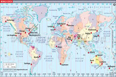
Most states observe daylight saving time during the summer months, which moves the clocks forward one hour, enabling the population to make better use of daylight. Daylight saving time begins on the second Sunday in March and ends the first Sunday of November. Arizona and Hawaii do not observe daylight savings time, instead opting to use standard time throughout the entire year in their Time Zones. Because of this, Arizona is part of the Pacific Time Zone part of the year, and the Mountain Time Zone for the rest of the year. However, the Navajo Nation, located within Arizona, does observe daylight saving time, and the Hopi Nation, inside the Navajo Nation, does not observe daylight saving time.
As shown on the US Time Zones Map, time zones do not always follow state lines, though most states are situated fully in one Time Zone or another. States near the edge of one of the Time Zones are sometimes divided into two Time Zones. States that are split between two Time Zones include Kentucky, Tennessee, North and South Dakota, Nebraska, and Idaho. Small portions of other states are also separated from the rest of their state in terms of Time Zones as depicted on the USA Time Zones Map.
| Time Zone Maps in Different Languages | |
|---|---|
| USA Time Zone Map in Spanish | USA Time Zone Map in Hindi |
| USA Time Zone Map in French | USA Time Zone Map in Germany |
| USA Time Zone Map in Portuguese | USA Time Zone Map in Arabic |
| FACTS TABLE | |
|---|---|
| Country Name | USA |
| Continent | North America |
| Timezone | (UTC-8:00) |
| Coordinates | 38.883333, -77.016667 |
| ISO Alpha-2 Code | US |
| ISO Alpha-3 Code | USA |
| Telephone Code | 1 |
| Capital | Washington DC |
| Largest City | New York City |
| Neighbouring Countries | Canada, Mexico |
| Area | 9,826,675 sq. km. |


