New Zealand Earthquake Map - M7.8 Strikes New Zealand |
 |
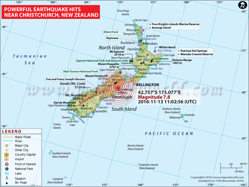
Earthquake of Magnitude 7.8 strikes South Island of New Zealand |
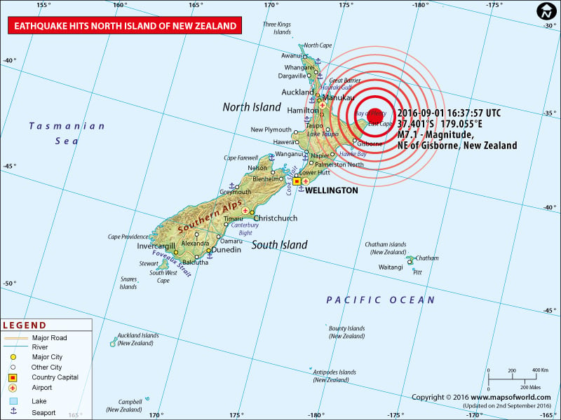
New Zealand Earthquake Map - M7.1 Strikes New Zealand |
 |
Earthquake of Magnitude 7.1 strikes central New Zealand |
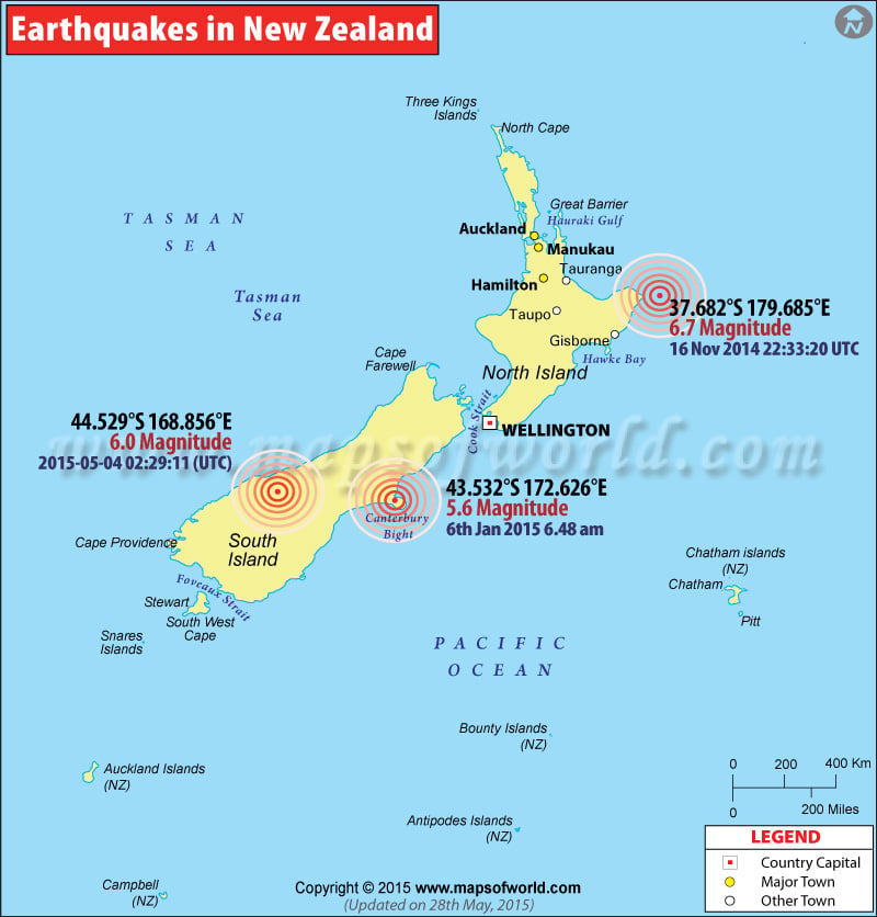
Earthquake Strikes north-east New Zealand |
 |
Map showing the epicentres of major earthquakes occured in New Zealand. |
New Zealand Earthquake Map
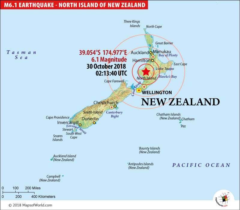
M6.1 Earthquake Strikes North Island of New Zealand on October 30, 2018

| Description :M6.1 Earthquake Strikes North Island of New Zealand on October 30, 2018 |
| Disclaimer |
Series of Quakes Killed Two
Nov 14, 2016 09:30:00 UTC: According to officials, two people have lost their life in the series of earthquakes that hit New Zealand's South Island early Monday. The further damage in the areas are being surveyed.
Government of New Zealand is now focusing on food, water, help and backup for the people of Kaikoura. As per reports, it will take time to open the roads of both north and south.
The coastal community of Kaikoura was struck by 7.8-magnitude quake in the midnight which triggered waves of 2.49 meters (8 feet) above usual tide levels. Later, another 6.2-magnitude quake struck 39 kilometers west-southwest of Kaikoura near north of Christchurch.
7.8 Magnitude Earthquake Rocks New Zealand
Nov 14, 2016 11:02:56 UTC: New Zealand was today hit by a 7.8 magnitude earthquake, which was one of the most powerful to occur in a century. As per United States Geological Survey, the epicenter of the earthquake was situated around 100 kms northeast of Christchurch, triggering off an alarm of an impending Tsunami.
The Christchurch Civil Defense Emergency Management has been called to action and people have been asked to evacuate to higher ground. The damage assessment was still going on.
Several aftershocks have followed since and the biggest fear now is the Tsunami that is expected. New Zealand lies at the collision point of the Indo-Australian and Pacific tectonic plates, and as a result experiences around 14,000 earthquakes in a year. Of these, only around 150 are felt.
The last major earthquake to hit New Zealand was of 7.1 magnitude and occurred just off the East Coast of North Island on 1 Sept earlier this year.
Also Explore: New Zealand Map, Where is New Zealand ?
| History of Earthquakes in New Zealand | |||
| Date | Location | Magnitude | Fatalities |
|---|---|---|---|
| Jan 23, 1855 | Wellington, New Zealand | M 8.0 | Fatalities 4 |
| Feb 2, 1931 | Hawke's Bay, New Zealand | M 7.9 | Fatalities 256 |
| May 23, 1968 | Inangahua, New Zealand | M 7.1 | Fatalities 2 |
| Aug 21, 2003 | South Island of New Zealand | M 7.2 | |
| Nov 22, 2004 | Off West Coast of South Island, N.Z. | M 7.1 | |
| Oct 15, 2007 | South Island of New Zealand | M 6.8 | |
| Dec 20, 2007 | Off east coast of the North Island, New Zealand | M 6.6 | Fatalities 1 |
| Jul 15, 2009 | Off West Coast of the South Island, New Zealand | M 7.8 | |
| Sep 3, 2010 | South Island of New Zealand | M 7.0 | |
| Feb 21, 2011 | Christchurch, New Zealand | M 6.1 | Fatalities 181 |
| Sep 01. 2016 | Gisborne, New Zealand | M 7.1 | |

