Earthquakes in El Salvador
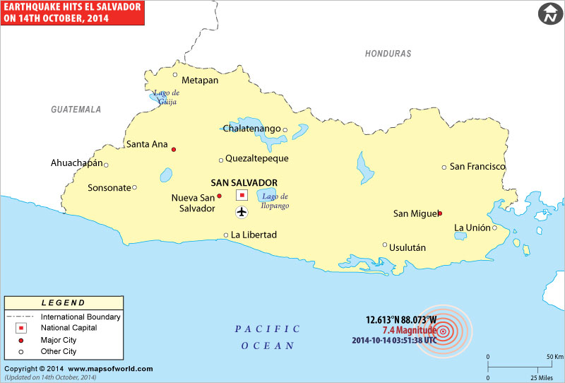
Earthquake hits El Salvador Coast

| Description :Map showing location of a strong Earthquake hits El Salvador coast. |
| Disclaimer |
Earthquake rocks El Salvador
El Salvador was rocked by a massive earthquake late Monday evening. The magnitude 7.4 earthquake struck off the coast of El Salvador. According to the US Geological Survey, the earthquake struck nearly 106 km south-southeast of the city of Usulutan. As per media reports, there have been no initial reports of damage but the El Salvador’s emergency services are taking all possible precautions. People living near the coast have been advised to move inland. As of now there are no early reports of damages or injuries in neighboring Honduras and Guatemala as well. View El Salvador Map for more.
WBPB14102014
| Earthquakes in El Salvador | |||
| Date | Location | Magnitude | Fatalities |
|---|---|---|---|
| May 6, 1951 | Jucuapa, El Salvador | M 6.2 | Fatalities 400 |
| May 3, 1965 | La Libertad, El Salvador | M 6.3 | Fatalities 125 |
| Oct 10, 1986 | El Salvador | M 5.5 | Fatalities 1,000 |
| Jan 13, 2001 | El Salvador | M 7.7 | Fatalities 852 |
| Feb 13, 2001 | El Salvador | M 6.6 | Fatalities 315 |

