Historic Earthquakes in Samoa |
 |
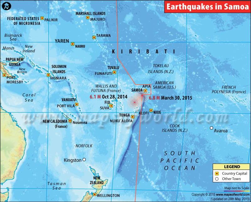
Map showing the epicentres of major earthquakes occured in Samoa. |
Earthquakes in Samoa
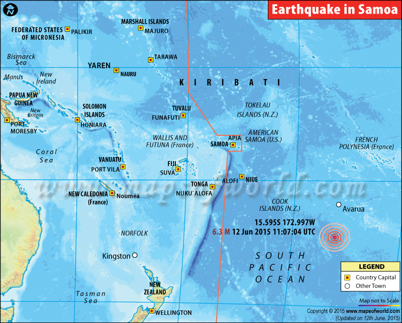
M6.3 Earthquake hits Samoa Islands- June 12, 2015

| Description :Map showing the epicentre of M6.3 earthquake in Samoa Islands on June 12, 2015(11:07:04 UTC) |
| Disclaimer |
*We specifically create maps that have a magnitude of 6 or more on the Richter Scale.
6.3 magnitude earthquake strikes Samoa Island region
A 6.3 magnitude earthquake was today reported in the Samoa Islands region. The earthquake had a depth of 28 km and its epicenter was located 89 km east-northeast of Hihifo, Tonga; 235 km southwest of Apia, Samoa; 281 km west-southwest of Tafuna, American Samoa; and 286 km west-southwest of Pago Pago, American Samoa. There is currently no information of damages or Casualties. More information is awaited.

