Location Map showing Earthquake in Vanuatu on Apr 30, 2016 |
 |
Location Map showing Earthquake in Vanuatu on Apr 30, 2016 |
Location Map showing Earthquake in Vanuatu on Apr 28, 2016 |
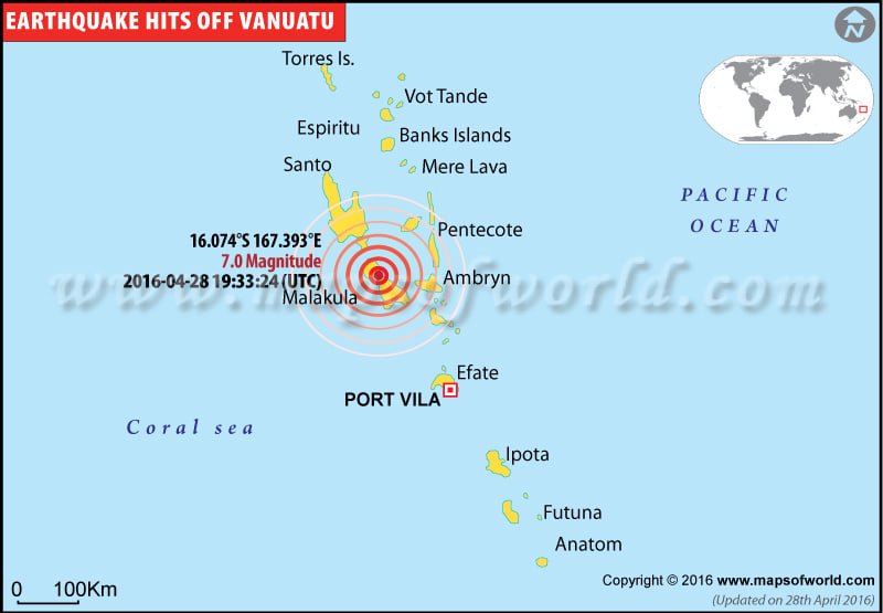 |
Location Map showing Earthquake in Vanuatu on Apr 28, 2016 |
Location Map showing Earthquake in Vanuatu |
 |
Location Map showing Earthquake in Vanuatu |
M6.7 earthquake in Vanuatu |
 |
Vanuatu was hit by another earthquake, the third to strike the country this week. |
M6.0 earthquake in Vanuatu |
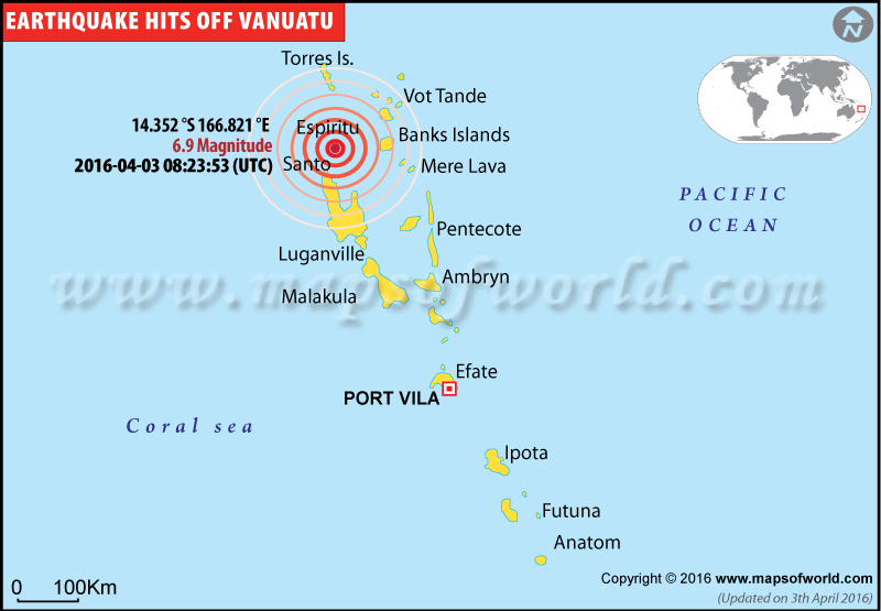 |
Map showing the epicentre of major earthquakes occurred in Vanuatu. |
Earthquakes in Vanuatu
Location Map showing Earthquake in Vanuatu on June 14, 2016
.jpg)
| Description :Location Map showing Earthquake in Vanuatu on June 14, 2016 |
| Disclaimer |
6.2 Magnitude Earthquake Hits Vanuatu on Tuesday, No Casualties Reported
June 14, 2016: A major earthquake of 6.2 magnitude hit Vanuatu on Tuesday. It is confirmed by the United States Geological Survey (USGS). No casualties or damage happened; and no warning of Tsunami is issued. Vanuatu comes under the 'Rings of Fire Zone', where tectonic movements are very common.
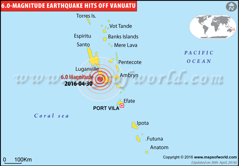
Magnitude-6.0 earthquake hits Vanuatu
April 30, 2016 - A magnitude-6.0 earthquake struck near Santo (Luganville), Vanuatu. There have been no tsunami warning and no loss of life or damage to property has been reported so far.
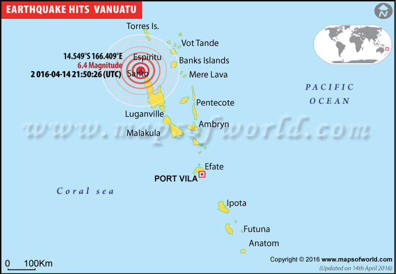
6.4-magnitude earthquake hits Vanuatu
April 14, 2016 - According to the U.S. Geological Survey, a 6.2-magnitude earthquake struck around 83 miles northwest of the Pacific island nation of Vanuatu. There have been no tsunami warning and no reports of casualties or damage to property.
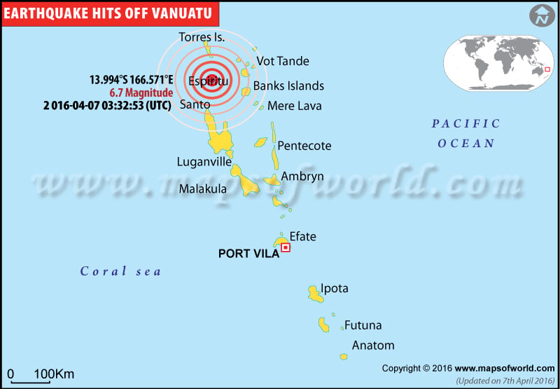
Vanuatu hit by a 6.7 magnitude earthquake
April 7, 2016 - Vanuatu was hit by another earthquake, the third to strike the country this week. As per the US Geological Survey, the 6.9 magnitude earthquake stuck some 118 miles northwest of the nation. There have been no reports of casualties or damage to property.
Vanuatu Earthquake: Magnitude revised down to 6.9; Tsunami threat withdrawn
April 3, 2016 - After the officials realized that the danger has largely passed and the magnitude of the earthquake was revised won to 6.9 instead of the initially measured 7.2, they withdrew the Tsunami threat in the South Pacific islands of Vanuatu.
Earthquake in Vanuatu: No tsunami threat to Australia
April 3, 2016 - The 7.2-magnitude earthquake, which took place near Santo (Luganville) at 08:24 UTC, has not caused any damage so far. There’s no tsunami threat to Australia's mainland. Only last October, an earthquake of magnitude 7.3 had struck off Vanuatu without causing any damage.
Earthquake of magnitude of 7.2 strikes off northern coast of Vanuatu; Tsunami warning issued
April 3, 2016- A powerful earthquake of magnitude of 7.2 on Richter Scale struck off the north coast of Vanuatu. According to the US Geological Survey, the South Pacific Ocean nation suffered the quake at 6.23pm (AEST) at a depth of 35 km. The epicenter of the earthquake is 81 km from Port Olry and 407 km from Port Vila, the capital city of Vanuatu. The authorities have issued a warning of a possible tsunami in the region.
7.3 magnitude earthquake strikes off Vanuatu
Oct 21, 2015 - A 7.3 magnitude earthquake struck near Vanuatu. As per the Pacific Tsunami Warning Centre, the earthquake occurred around 46 kilometers northeast of Port-Olry or approximately 339 kilometers north-northwest of Port-Vila. Media reports stated, no tsunami warning has been issued in the region and there are no reports of damage or loss to life. The earthquake was strong enough to register in New Zealand.
