| About Durham, New Hampshire | |
|---|---|
| Location: | Durham |
| Latitude: | 43.08N |
| Longitude: | 70.56W |
Durham, New Hampshire
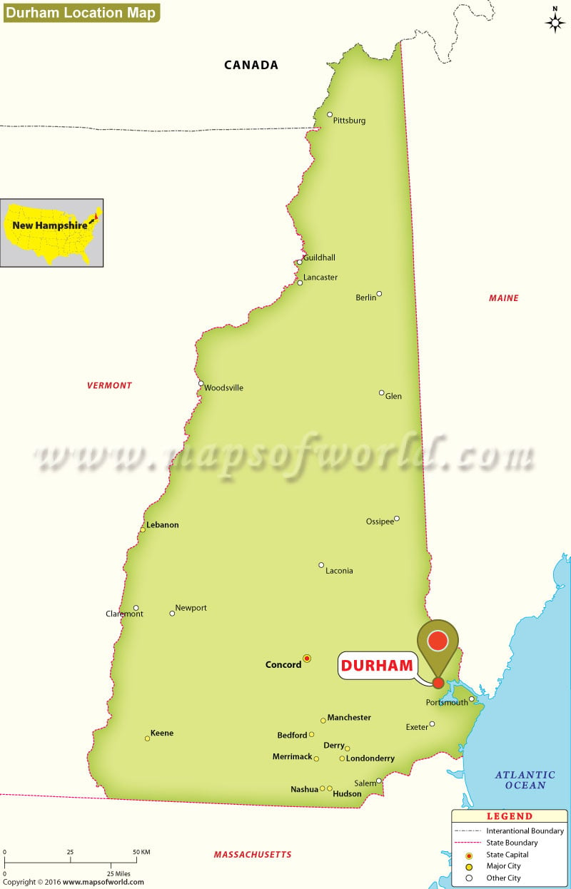
Durham is located in Strafford County in the state of New Hampshire. Spread over an area of 24.8 square miles, the town is home to a population of approximately 14,638 as per the 2010 census. The town is home to one of the biggest university in the United States – the University of New Hampshire. The town was settled in 1635 by pioneers; however, at that time it was a part of Massachusetts. The town was incorporated in 1732. The Beech Hill, which has a height of 291 feet, is the highest point in the state. Some places that one should visit while in Durham include Pettee Hall, Taylor Hall, Diamond Library, St Thomas More Parish, Adams Point and many others.
The map provides the user with information about the exact location of Durham and some important cities that are located close to it. Apart from this, the map also gives details regarding the states that Maine shares its borders with.
MOW.PB.21.12.2016
| Location Map of New Hampshire Cities |
Last Updated on : September 07th, 2017


