Getting in and Around
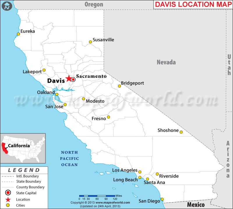
The city is about 11 miles (18 km) west of Sacramento.
By Air – Sacramento International Airport (SMF) is the nearest major airport.
By Rail – Amtrak's California Zephyr, Capitol Corridor, and Coast Starlight operate through Davis.
By Road – The city lies at the intersection of Interstate 80 and State Route 113. YoloBus provides public transportation to nearby towns.
Best Time to Visit
The city witnesses dry summers and rainy winters. Shoulder seasons of spring and fall are the best time to visit Davis.
What's in Davis
The self-guided public art tour Davis Transmedia Art Walk includes 23 public murals, 16 sculptures, and 15 galleries and museums in downtown Davis and the campus of University of Davis.
Founded in 1936, the UC Davis Arboretum, along the banks of the Putah Creek, features 22,000 Mediterranean flora in its 17 gardens. Wildhorse Golf Club, Community Park, and Shields Grove and Gazebo are other popular green spaces in Davis.
The Davis Farmers Market, held every Wednesday evening and Saturday morning, sells fruits and vegetables, baked goods, dairy and meat products, crafts, and flowers. The city celebrates two annual events: Celebrate Davis and Picnic Day.
| City Name | Davis |
|---|
| Continent | North America |
| Country | United State (USA) |
| State | California |
| Capital and largest city | NA |
| Area | 9.919 sq mi (25.690 km2) |
| Population | 65,622 (April 1, 2010) |
| Lat Long | 38°33′14″N 121°44′17″W |
| Official Language | English |
| Calling Code | 530 |
| Time Zone | Pacific (UTC−8) Summer (DST) PDT (UTC−7) |
| Airport | |
| Neighbour Countries | Oregon, Nevada, Arizona, Mexico |
| Internet TLD | .ca |
| Currency | United State Dollar (USD) |
Last Updated on: July 06th, 2016


