Search U.S. City Location
| Email This Link | Save |

Disclaimer : All efforts have been made to make this image accurate. However MapSherpa, Inc, its directors and employees do not own any responsibility for the correctness or authenticity of the same.
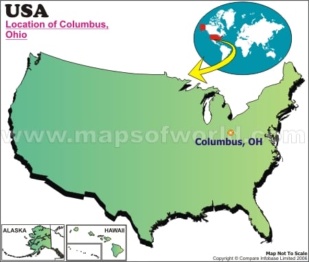
| City | Columbus |
|---|---|
| Continent | North America |
| Country | United State (USA) |
| State | Ohio |
| County | Delaware, Fairfield, Franklin |
| Area | 223.11 sq mi (577.85 km2) |
| Population (year) | 787,033 (2010) |
| Lat Long | 39°59′N 82°59′W |
| Official Language | De jure: None De facto: English |
| Area Code | 614, 380 |
| Zip Code (s) | 43085, 43201-43207, 43209-43224, 43226-43232, 43234-43236, 43240, 43251, 43260, 43266, 43268, 43270-43272, 43279, 43287, 43291 |
| Time Zone (s) | EST (UTC-5) Summer (DST) EDT (UTC-4) |
| Airport (s) | Port Columbus International Airport |
| Neighbour State | Michigan, Pennsylvania, Kentucky, Indiana, West Virginia |
| Currency | United State Dollar (USD) |
| Official Website | https://www.columbus.gov/ |
| Location Map of Ohio Cities |


