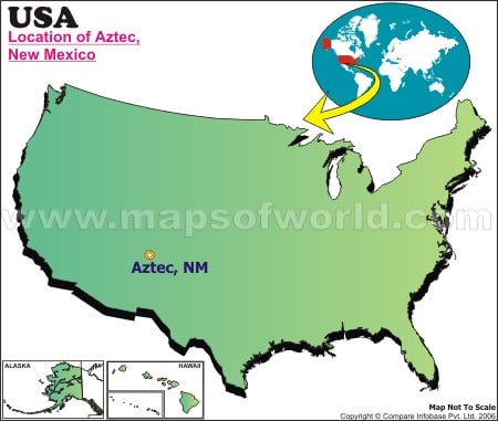
| Location: | Aztec |
| Latitude: | 36.49N |
| Longitude: | 107.59W |
The Aztec Ruins National Monument is located close to Aztec, New Mexico. It contains ancestral Pueblo structures built in 1100 AD, along the Animas River. They were added to the UNESCO World Heritage Sites list in 1987. These Aztec Ruins provide visitors with an enriching experience of getting acquainted with ancestral Pueblo site and visiting the nations largest reconstructed Great Kiva, a building that inspires contemplation and wonder.
The Aztec Museum contains one of the finest collections of authentic pioneer Americana and an extensive collection of fossils, Southwestern artifacts, early telephone exhibit, farm and ranch tools, etc. A walk down the Pioneer Village here promises to take one back into Aztec history. It contains numerous reconstructed historic buildings, used by early settlers of San Juan County. Plan a New Mexico travel to enjoy Aztec City Parks, about 29 miles of mountain bike Aztec trails, quality fishing in Novajo Dam area of San Juan River, and have lots of fun at the Aztec Speedway.
Last Updated Date: September 4th, 2017
| Location Map of New Mexico Cities |


