| Facts About Attalla |
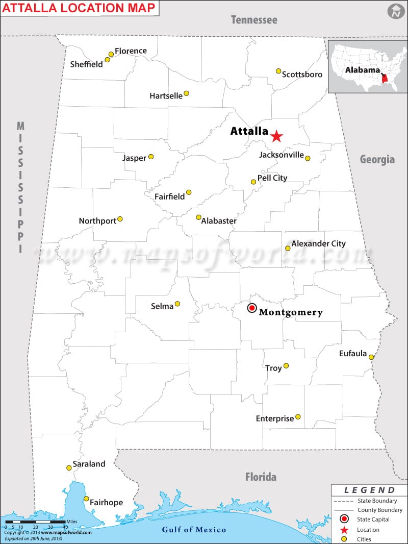
| City Name | Attalla |
|---|---|
| Continent | North America |
| Country | United States |
| State | Alabama |
| County | Etowah |
| Area | 7.0 sq mi (18.1 km2) |
| Population | 6,048 (2010) |
| Lat Long | 34°0′35″N 86°5′54″W |
| Official Language | English. |
| Calling Code | 256 |
| Time Zone | Central (CST) (UTC-6) Summer (DST) CDT (UTC-5) |
| Nearest Airport | Northeast Alabama Regional Airport |
| Currency | United State Dollar (USD) |
How to Reach Attalla:
The closest major airport and train station (served by Amtrak's Crescent) is roughly 55 miles away in Birmingham. Interstate 59 traverses the eastern edge of the city. U.S. Highways 431 and 11, along with State Route 77, are major roads to access.
Things to Do in Attalla:
Last Updated On: September 2nd, 2017
| Location Map of Alabama Cities |


