logo

Where is Albertville Located in Alabama, USA

Search U.S. City Location

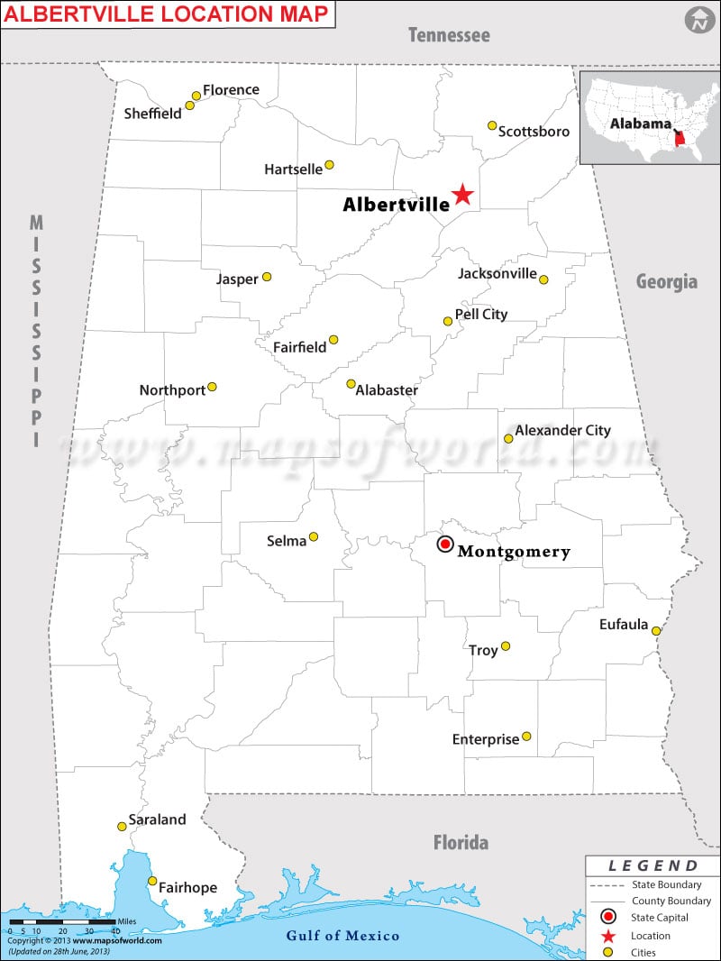
Albertville is a city located just south of the Tennessee River in Marshall County in North Alabama. The city billed itself as "Fire Hydrant Capital of the World."
Location : Albertville Latitude : 34.27N Longitude : 86.21W

Where is Albertville, Alabama

Description:Map shows where is Albertville located in Alabama state. Disclaimer
×

Disclaimer  :  All efforts have been made to make this image accurate. However MapSherpa, Inc, its directors and employees do not own any responsibility for the correctness or authenticity of the same.

Facts About Albertville

City Name Albertville
ContinentNorth America
CountryUnited States
StateAlabama
CountyMarshall
Area26.1 sq mi (67.5 km2)
Population21,556 (2013)
Lat Long34°15′55″N 86°12′40″W
Official LanguageEnglish.
Calling Code256
Time ZoneCentral (CST) (UTC-6) Summer (DST) CDT (UTC-5)
Nearest AirportAlbertville Municipal Airport
CurrencyUnited State Dollar (USD)


How to Reach Albertville:

The nearest airport is Birmingham–Shuttlesworth International Airport (BHM). Anniston station, served by Amtrak's Cresent, is roughly 55 miles southeast from the city. U.S. Route 431 and Alabama State Highway 75 intersect in the heart of Albertville.

Things to Do in Albertville:

  • Check out mysterious formations in Cathedral Caverns State Park

  • Enjoy kayaking in Mountain Lake Water Recreation

  • Have a family outing at Lake City Amusement Park

  • Pay a visit to Jules J. Berta Vineyards

  • Celebrate annual Festival of Trees at the Guntersville Museum

  • Hang around in Albertville for Main Street Music Festival

  • Pick up groceries from La Orquidea

  • Bargain with farmers and food artisans at Albertville Farmers Market

  • Sample a delicious slice at Giovanni's Pizza or taste chicken wings at Jefferson's Restaurant

  • Make dinner reservations at Catfish Cabin

  • Arrange a field trip to Arab Historic Village


Location Map of Alabama Cities


Last Updated on: June 30, 2020