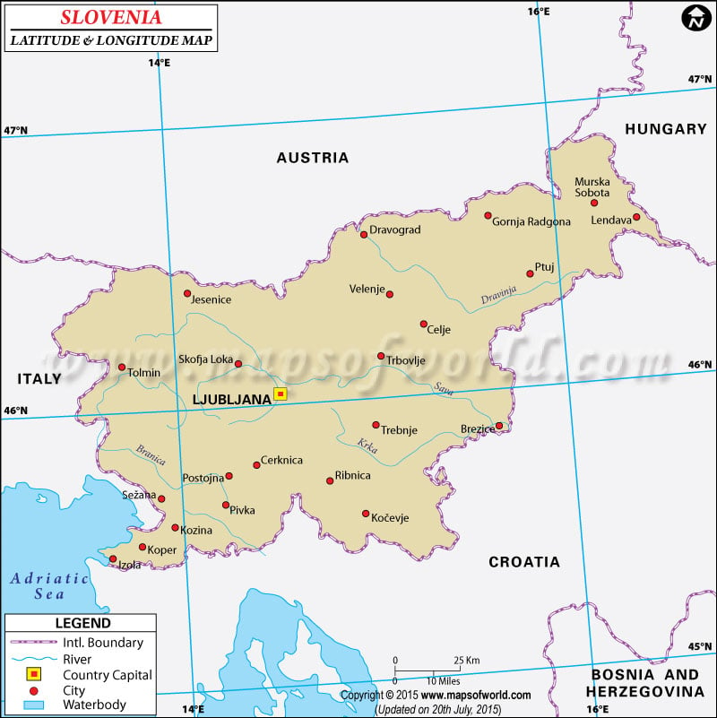
|
| Description : Find Slovenia latitude and longitude map showing comprehensive details including cities, roads, towns, airports and much more. | Disclaimer |
Get Custom Mapping Quote +1 (866) 525-2298 | sales@mapsofworld.com

Search For Latitude & Longitude Map
Or
Latitude
Longitude
Or
Area
* Put South & West values with minus ( - ) sign.

|
| Description : Find Slovenia latitude and longitude map showing comprehensive details including cities, roads, towns, airports and much more. | Disclaimer |
| Locations | Latitude | Longitude |
| Celje | 46°16'N | 15°18'E |
| Kalce | 45°54'N | 14°13'E |
| Kobarid | 46°15'N | 13°30'E |
| Koper | 45°31'N | 13°44'E |
| Kranj | 46°16'N | 14°22'E |
| Ljubijana | 46°04'N | 14°33'E |
| Maribor | 46°36'N | 15°40'E |
| Novo Mesto | 45°47'N | 15°12'E |
| Postojna | 45°46'N | 14°12'E |
| Triglav | 46°21'N | 13°50'E |