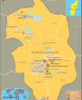
The latitude and longitude of Rwanda is 2º 00' S and 30º 00' E respectively. It is located in central Africa and lies to the east of Democratic Republic of the Congo.
The total area is slightly smaller than that of Maryland. Kigali, the capital is located within 1º 57' S and 30º 04' E latitude and longitude respectively. Rwanda comprises of 5 provinces and is seven hours ahead of Washington DC during Standard Time.
The total area of Rwanda is 26,338 square kilometers and it is a completely landlocked area. The terrain consists of mostly grassy upland and hills. The geographical relief of the region is mountainous with altitudinal heights decreasing from west to east. The
climate of Rwanda is mostly of temperate type with two rainy seasons spanning from February to April and November to January. Some amount of frost and snow is not uncommon during winters and especially in the mountainous areas. Certain areas suffer from periodic droughts at times.
| Locations |
Latitude |
Longitude |
| Butare | 02°31'S | 29°52'E |
| Byumba | 01°35'S | 30°04'E |
| Cyangugu | 02°29'S | 28°54'E |
| Gahini | 01°50'S | 30°30'E |
| Gisenyi | 01°41'S | 29°15'E |
| Kibungo | 02°10'S | 30°32'E |
| Muranda | 01°52'S | 29°20'E |
| Nyanza | 02°50'S | 29°42'E |
| Ruhengeri | 1°30'S | 29°36'E |


