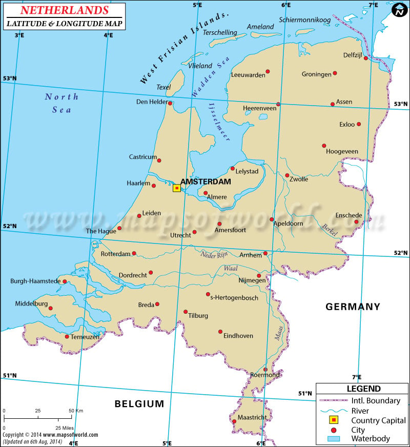
Netherlands is located in between the Arctic Circle and the Tropic of Cancer. The country lies between Germany and Belgium. Hence, the temperature is moderate all over the year. The latitude and longitude of the country is 52°23' N and 4°55' E respectively.
The major Netherlands latitude and longitude is 52°23' N and 4°55' E. The country is situated between Germany and Belgium. The area in between the latitude and longitude of Netherlands is approximately 41,526 sq km. The latitude of the country is in between the Arctic Circle and Tropic of Cancer. The temperature is cool in the summers. The winters are not severe due to the location. The North Sea touches the country and forms boundary from one side. Hence, the winters are not too chilly. The timing followed in the country is one hour added to the UTC. The geographic position of Netherlands is one longitude in the east of Prime Meridian. Six hours time difference is present between Washington DC and Netherlands.
- 1 degree = 111 km NS, 68 km EW (the proportion is 0.61, the cosine of the latitude)
- 1 second = 31 m NS, 19 m EW
- 1 minute = 1,850 m NS (ca. 1 nautical mile), 1,140 m EW
(Rijksdriehoeksmeting) or The Dutch RD coordinate system and converter are frequently used. There is a south-north coordinate between 300 and 620 km and west-east coordinate between 0 and 280 km.
Our Lady's Tower (Onze-Lieve-Vrouwentoren) in Amersfoort is the reference point with geographic coordinates around 52°9'N 5°23'E/52.15°N 5.383°E/52.15; 5.383 and RD coordinates (155.000, 463.000).
The European territory of the Netherlands is situated between latitudes 50° and 54° N, and longitudes 3° and 8° E.
Latitude and Longitude of Netherlands |
|---|
Last Updated on: November 17th, 2017


