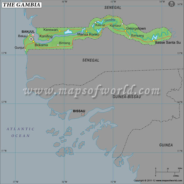
The Republic of
Gambia is located in West Africa with a
Latitude and
Longitude of 13°28'N and 16°34'W respectively.
Gambia has an area of 11,300 sq km spanning across its Latitude and Longitude. The capital city of Banjul is geographically located at a Latitude and Longitude of 13°28'N and 16°36'W. Serrekunda is the largest city of Gambia, having a Latitude of 13°28'N and a Longitude of 16°39'W.
Due to its geographic location, the climate of Gambia is tropical. The period of June to November is the time for the distinctive hot and very humid rainy season. The months of November to May bring considerably pleasant weather when it is cool and dry. Gambia has a low lying terrain, the plains get flooded by the River Gambia every monsoon. There are some low hills in the region as well.
The population of Gambia stands at 1,688,359 according to current estimates. The Gambian population is mainly composed of ethnic African tribes like the Mandinka, the Fula, the Wolof, the Jola and the Serahuli.
Latitude and Longitude of Gambia |
|---|
| Location | Latitude | Longitude |
|---|
| Banjul | 13°28'S | 16°40'W |
| Bathurst/Banjul | 13°28'N | 16°40'W |
| Georgetown | 13°30'N | 14°47'W |
Last Updated on: November 14th, 2017


