logo


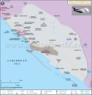
Aruba Latitude and Longitude Map

Aruba's latitude and longitude is 12° 30' Nand 69° 58' W . Below is the map of Aruba showing major towns, roads, airports with latitudes and longitudes plotted on it.
Aruba Latitude and Longitude Map
Description : Find Aruba latitude and longitude map showing comprehensive details including cities, roads, towns, airports and much more. Disclaimer
×

Disclaimer  :  All efforts have been made to make this image accurate. However MapSherpa, Inc, its directors and employees do not own any responsibility for the correctness or authenticity of the same.


Search For Latitude & Longitude Map

By Country

Or

Latitude

Longitude

Or

Area

* Put South & West values with minus ( - ) sign.

Aruba is an island travel destination that is situated in the Caribbean Sea. The latitude and longitude measurements of Aruba are, 12°30' North and 69°58' West.

The Equator also passes by Aruba very closely. Because of the location among these latitude and longitude, Aruba has a weather that is marked by almost a perpetual summer throughout the year.

Latitude and longitude have a great effect on Aruba climate and subsequently on its economy. In Aruba there is very little difference between the summer and winter temperature and also between day and night temperatures. A very enjoyable, shiny and clear climate reigns in Aruba which is the main reason behind developing Aruba as a tempting travel destination. At present tourism industry in Aruba is one of its main economical strengths apart from oil refinery and gold mining. Behind making Aruba's economy strong the role played by its latitude and longitude is very strong.


Latitude and Longitude of Armenia

LocationLatitudeLongitude
Oranjestad12°32'N70°02'W

Last Updated on: November 7th, 2017