Kurdistan
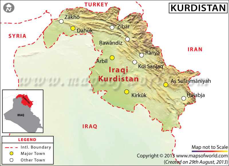
Kurdistan is a geo-cultural region occupied by Kurd People. In fact, Kurdistan is almost a nation with over 22 million population and a distinctive culture and society but without a state. It covers continguous portions of Turkey, Iran, Iraq, and Syria. This mountainous region extend from south-eastern Turkey to the northern part of Iraq, north eastern part of Syria and eastern part of Iran. Kurd people speak Indo- European language part of Iranian group of languages and are mainly Sunni Muslims.
Geography
Kurdistan covers a total area of about 190,000 to 390,000 sq. km., some of the major towns and cities of this region are Bitlis, Van and Diyarkar in Turkey, Kermanshah, Mahabad and Sanandaj in Iran and Slemani and Arbil in Iraq. Kurdistan in Syria covers the smallest region in the total area about 12,000 sq. km. Irani Kurdistan comprises Kurdistan Province, IIam Province and Kermanshah Provinces of Iran. Iraqi Kurdistan has three governorates under the Kurdistan Regional Government. Syrian Kurdistan comprises major part of Al Hasakah Province.
Kurdistan is broadly divided into upper and lower Kurdistan with the northern and northeastern and northwestern part as upper Kurdistan and the southern part as lower Kurdistan. The climate in this mountainous region is mainly continental type with very cold winter and hot summer.
History
People of Kurdistan has had a long history of struggle for their cause of an independent state but have not yet achieved the success, mainly because Kurdistan overlaps borders of four independent states. Kurdish Principalities had emerged in the 10th and 11th century and had maintained their perquisite rights till the beginning of 19th century. Major division of Kurdistan occurred post the Battle of Chaldiran in 1514 between the Persian and Ottoman Empire and it was in 1639 that the Treaty of Zuhab was signed as an agreement on the border between the empires. In the period between 1555 to 1918 several treaties were signed between the empires to redefine the disputed border. However it was in the beginning of 19th century only that a rough outline of the present day states of Iran, Turkey and Iraq were formalized. Post the World War 1 the Ottoman Empire lost its territories to Middle East. In the first half of the last century the Kurdish revolt remained largely traditional uprisings. Post the Second World War also the nationalism movement remained qualitatively and quantitatively weak. At present separate nationalist movements are active in Iran, Iraq, Syria, and Turkish Kurdistan in demand of separate Kurdistan state.
Economy
Kurdish economy was traditionally based on agriculture and pastoralism. Kurds are mountain people with most of their activities based out of the region. Iraqi Kurdistan’s economy is depended on oil industry, tourism and agriculture, thus economically this region is more developed than rest of Iraq and neighboring country of Syria. In Iranian Kurdistan as well as most part of the Kurdistan region apart from the oil industry, mineral mining industry also support the economy of the region. In fact, oil reserves in the entire Kurdistan region is the largest in the entire Middle East. Tourism is also another growing industry of this region.
References: merip.org;
Media reports
WBGM15092014
Last Updated on: February 24, 2020


