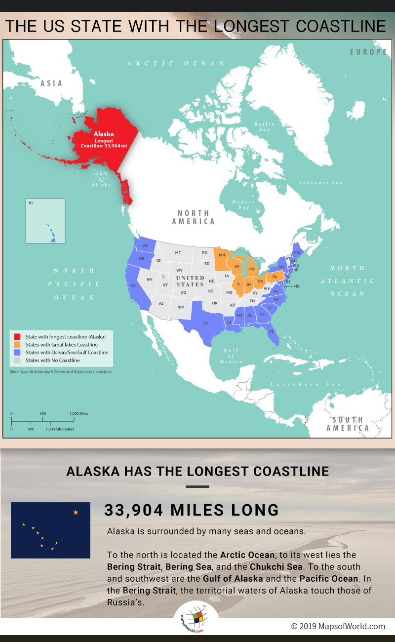

Infographic Shows Map Depicting US State Having The Longest Coastline.
The United States is the third largest country in the world comprising an area of 3,796,742 square miles. The country has an equally huge coastline which measures a whopping 95,439 miles, as per the National Oceanic and Atmospheric Administration (NOAA). Let’s explore “Which state has the longest coastline?“, not only this we’ll also take a look at how long the coastlines are for all the states in the U.S.
Of all the states, Alaska has the longest coastline. According to the NOAA, the coastline of the state is 33,904 miles long. Incidentally, Alaska is also the largest state in the country.
The top 5 states with the longest coastlines are:
Alaska has the longest coastline in the United States, measuring approximately 33,904 miles. It stretches along the Arctic Ocean, Pacific Ocean, and the Gulf of Alaska. Its coastal areas feature stunning fjords, glaciers, and diverse marine life. Remarkably, Alaska’s coastline is longer than the coastlines of all other U.S. states combined.
Florida’s coastline is like a sunny paradise with warm waters from the Gulf of Mexico and the Atlantic Ocean. It measures approximately 8,436 miles. The Florida Reef, the only living coral barrier reef in the continental United States, is part of the expansive coastline.
Louisiana’s coastline is uniquely shaped by the Mississippi River Delta, stretching for 7,721 miles. It is a hub for economic activities like oil and gas production. The coastline is crucial for biodiversity, providing habitats for numerous species of fish, birds, and other wildlife.
Texas Gulf Coast is a blend of sandy beaches, estuaries, and bays along the Gulf of Mexico. It stretches for approximately 3,359 miles. It is a significant economic driver, supporting industries such as energy, shipping, and tourism. The Padre Island National Seashore in Texas has the longest stretch of undeveloped barrier island in the world.
California’s coastline is renowned for its diversity, featuring rocky cliffs, sandy beaches, and iconic landscapes along the Pacific Ocean. It stretches for approximately 3,427 miles. It is a hotspot for outdoor activities and tourism. The Big Sur coastline is home to McWay Falls, an 80-foot waterfall that cascades directly onto the beach.
Of the 50 states of the United States, 30 have a coastline. Those 30 states are:
The states which do not have any coastline in USA are:
If you are interested in exploring more about these states, check out our: US State Map. You can see all the 50 states and click on any state to see its own map.
Related Links
The Republic of Madagascar is an island country located in the Indian Ocean, off the…
The Euro is the official currency of the European Union. It is, however, not incumbent…
There are many countries or regions that are partially recognized by the UN, have disputes…
The Alaska Statehood Act was signed into law by President Dwight D. Eisenhower in 1958,…
The name Persia may, however, only be used to refer to Iran in some contexts.…
Hawaii is an Island State in the US. It is one of the 50 states…