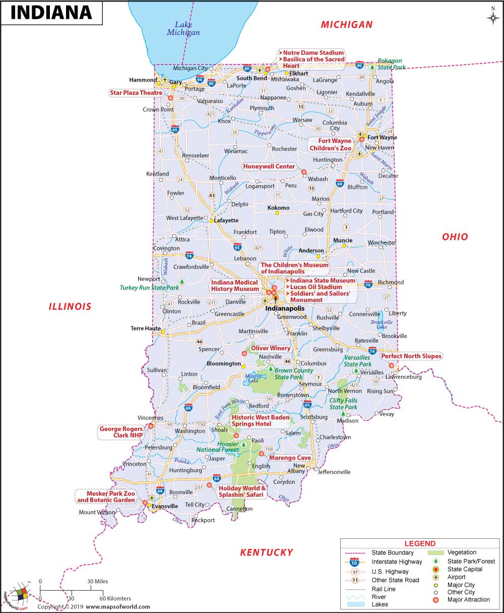
What are the Key Facts of Indiana?
State Indiana State Capital Indianapolis Largest City Indianapolis Coordinates 40°N 86°W Nickname(s) “The Hoosier State” Postal Abbreviation IN Area 36,418 sq. miContinue Reading…
![]()

State Indiana State Capital Indianapolis Largest City Indianapolis Coordinates 40°N 86°W Nickname(s) “The Hoosier State” Postal Abbreviation IN Area 36,418 sq. miContinue Reading…
![]()

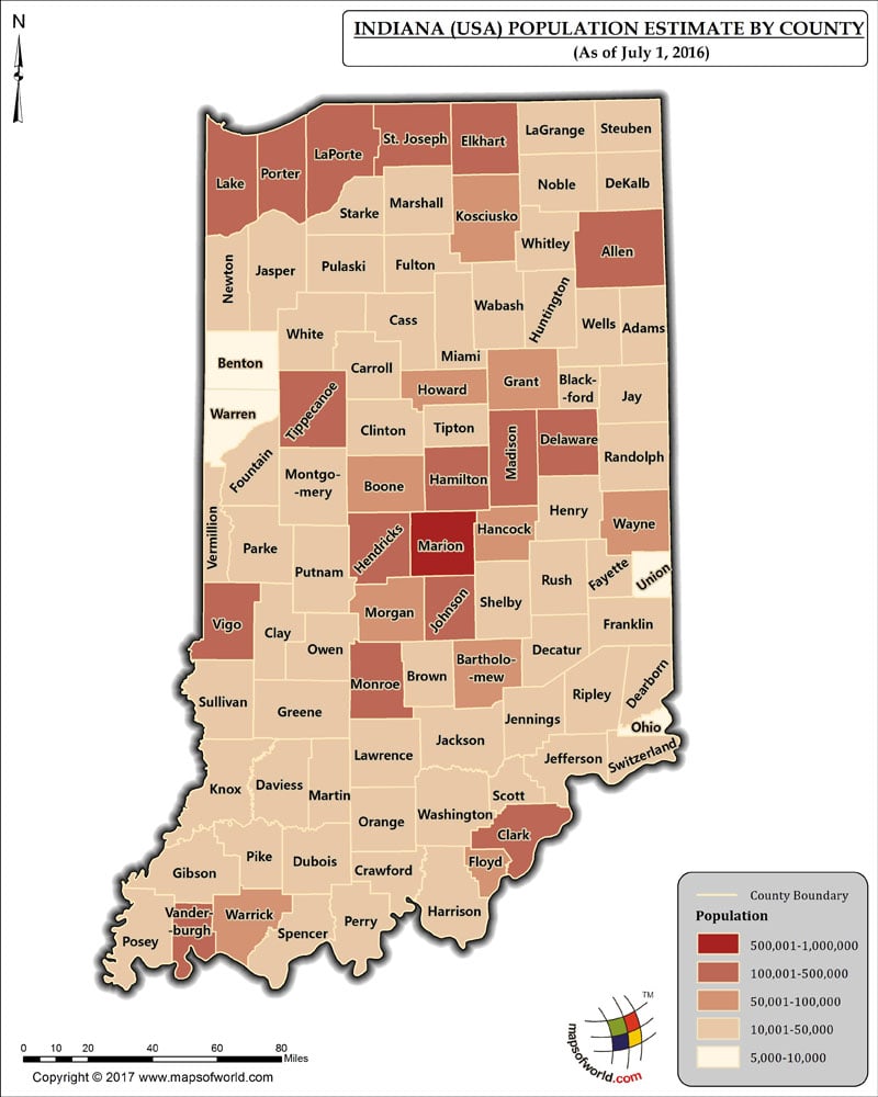
The Population of Indiana, which has 92 Counties, as per July 1st, 2016 estimate, is 6,483,802 (Six million four hundred eighty-three thousandContinue Reading…
![]()