World Map »
world-maps » world-map-for-kids
World Map for Kids

Map of the World for Kids :
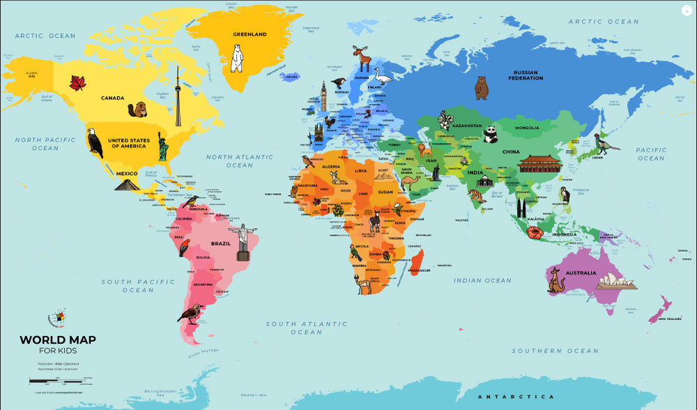
World maps show the entire Earth, including the continents and the oceans. On the World Map for Kids, each of the continents is shown in a different color, and the oceans are colored light blue.The World Map for Kids
Continents
Earth's land is separated into seven continents, which are the large landmasses shown on the map in various colors. The continents shown on this map are North America, South America, Europe, Asia, Africa, and Antarctica. Sometimes North and South America are considered one continent. Europe and Asia have also been considered one continent, because they are connected, but they are culturally very distinct.
Many of the continents are divided up into smaller areas, called countries. Each country is usually ruled by its own government. Countries can be very large or very small. The largest country in the world is Russia, shown as part of Asia (although sometimes it is considered part of Europe). The smallest country is Vatican City, located inside Italy on the European continent. Australia is both a continent and a country. Know more ...

