
Map of Portuguesa state (estado), Venezuela illustrates the administrative divisions, state (estado) boundary, international boundary, coastline and state capital.
Portuguesa Map
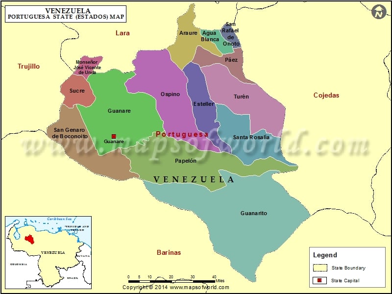
Description : Map showing the administrative divisions of the Portuguesa state (estado), Venezuela.