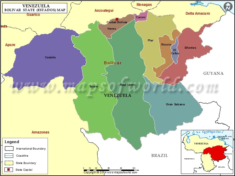
Bolivar, which is one of the most important states in Venezuela, is located on the bank of the Orinoco River in Venezuela. Bolivar in Venezuela was founded on the 21st of December in the year 1595 by Santo Tomas Apostle.
The state of Bolivar covers an area of 240528 square kilometers with a population density of about 5.15 habitants /square kilometers. Present Bolivar is divided into 11 municipalities.
Bolivar is the hub for the industries in Venezuela. The industries include minings, farming and many more. The immense growth of industries in this region is also dependent on the availability of the natural resources. The rivers support the generation of hydro electricity and thus encourages in the growth and the development of the economy of the country.
The National Parks of Bolivar contribute to the heritage of the state. Bolivar Venezuela, with its territorial beauty as well as magnificent culture, attracts people from all over the world. The magnificent Angel Falls is also a great attraction for the tourists. The tropical climate of the state helps in tourism as well as vegetation, both of which help in the economic growth of the state.
Municipalities of Bolivar State (Estado) |
| Municipality | Capital | Population | Area(km.²) |
|---|---|---|---|
| Caroní | Ciudad Guayana | 646,541 | 1,612 |
| Cedeño | Caicara del Orinoco | 57,917 | 46,020 |
| El Callao | El Callao | 17,410 | 2,223 |
| Gran Sabana | Santa Elena de Uairen | 9,220 | 32,990 |
| Heres | Ciudad Bolivar | 292,833 | 5,851 |
| Padre Pedro Chien | El Palmar | 12,194 | 2,275 |
| Piar | Upata | 89,410 | 18,175 |
| Raúl Leoni | Ciudad Piar | 30,062 | 54,388 |
| Roscio | Guasipati | 18,831 | 6,182 |
| Sifontes | Tumeremo | 26,947 | 24,393 |
| Sucre | Maripa | 13,481 | 48,694 |

