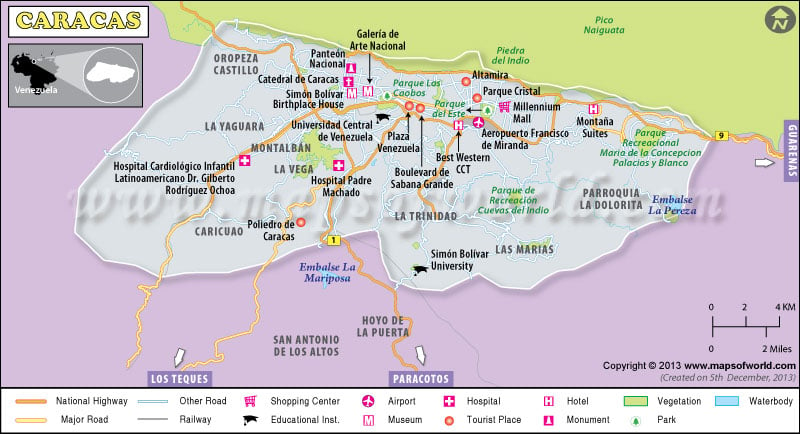
Caracas, the capital of Venezuela, was founded by Diego de Losada in 1567. Caracas in Venezuela, situated in a long valley, which stretches from east to west, is about 3000 feet above the sea level. With a population of about four million, Caracas happens to be the most populated city in Venezuela. The soothing climate because of the high altitude of the city, is definitely favorable for human inhabitation as well as growth of agriculture.
During the 1970s and 80s, due to the oil booms, the growth of Caracas Venezuela was remarkable. The traditional colonial buildings were then replaced with modern high-rises. Thus it holds the position of highest importance among the States in Venezuela. However Caracas still preserves a few historic architectures.
Caracas is also known to be the cultural center for Venezuela. Along with the incomparable beauty of the nature, the museum of modern art is one of the main attractions of the city. The unique mode of transport, which is the cable car, is extremely alluring for the tourists. Caracas is characterised by its vibrant dwellers who come from every end of the economic spectrum.
The shopping malls and the recreational zones are never missed out by the tourists. There a number of exquisite hotels and restaurants, which form an integral part of the city’s culture. Caracas provides its visitors with lovely sightseeing opportunities, which are provided by the lovely natural wealth that encircles the city. The Maiquetia International Airport helps in the growth of tourism as well business in Caracas.

