Where is USA?

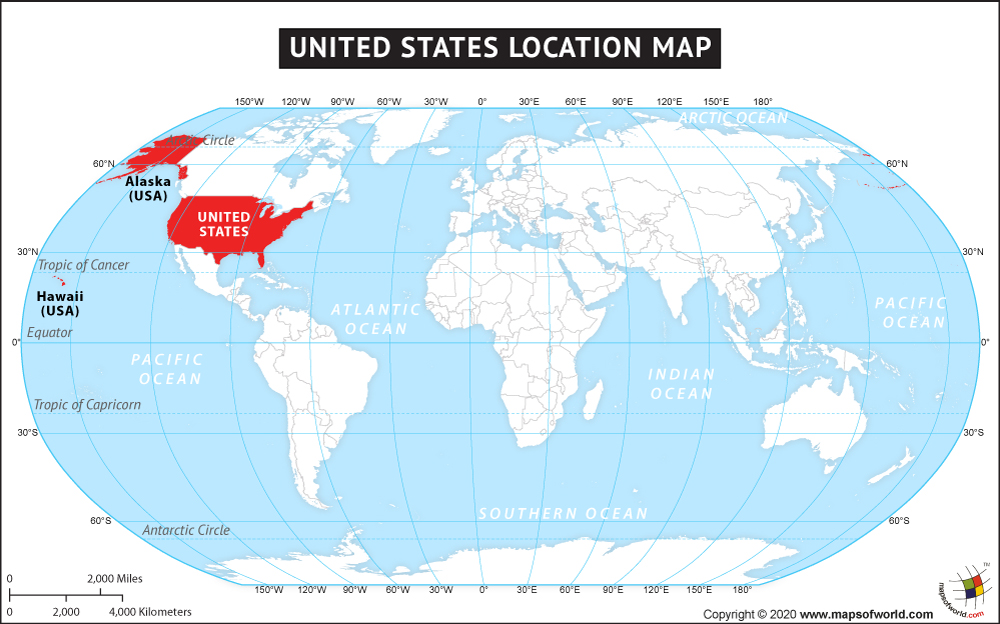
Description : Map showing location of the United States of America (USA) in the World.
Where Is The United States Of America Located?
The third largest country in the world, the United States of America is located in North America between Mexico, to its south, and Canada, to its north.
The US is divided into fifty states, and one federal district. Washington D.C., is the capital city (Washington DC Map). The states of Alaska and Hawaii, are the only two states not sharing a contiguous boundary with the country. Alaska is situated to the northwest corner of North America, sharing its border with the with Canada, and Hawaii Island is an archipelago in the Pacific Ocean. The US also has many territories in the Pacific Ocean and the Caribbean Sea. One of the most developed countries of the world, the US covers a total area of 3,794,100 square miles (9,826,675 sq. km), including states and the federal district, and not any overseas territories.
USA is a multicultural country, as it has historically welcomed immigrants for all over the world. It also has rich reserve of natural resources and biodiversity. To top it off, the US is one of the most preferred destination for tourists from worldwide.
To learn more, visit our United States Of America section.
ABOD20170728
USA - Quick Facts |
|---|
| Country Name | USA |
|---|---|
| Continent | North America |
| Capital | Washington, D.C. |
| largest city | New York City |
| Area | 9,826,675 km2 (3,794,100 sq mi) Water (%) 6.7 |
| Population | 320,925,485 (2015 Est.) |
| Lat Long | 37.843322, -105.948203 |
| Official Language | None at federal level |
| Calling Code | +1 |
| Time Zone | (UTC−5 to −10) Summer (DST) (UTC−4 to −10 ) |
| Airport | 2212 Airports in United States |
| Neighbour countries | Bahamas, Canada, Cuba, Mexico |
| Internet TLD | .us .gov .mil .edu |
| Currency | United States dollar |
Location Map of US States |
|---|

