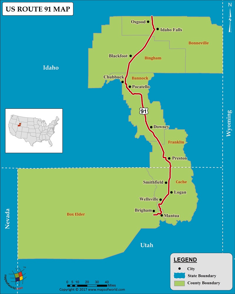
US Route 91 Map

Description : US route 91 map showing the path of highway 91 with states and cities covered.
US Route 91
US Route 91 is a small route covering just 172.6 miles, and connecting two states, Utah and Idaho. Nevertheless, it is an important route of the United States Number Highway System, and passes through many cities and towns. US Route 91, starts at Brigham City in Utah, and ends at the junction with US 26, in Idaho Falls, Idaho. Along the way it passes through the cities of Blackfoot, Chubbuck, Pocatello, Downey, Preston, Smithfield, Logan, and others.
Route 91, which has been in existence since 1926, was much larger and covered more states prior to the 1970s. At the time, Route 91 began in Long Beach, California, and went all the way to Sweetgrass, Montana. Until 1974, US Route 91 passed through California, Nevada, and Arizona, and until 1980, it passed through Montana as well. Route 91 has largely been replaced by I-15. The major junctions that connect US Route 91 are; I-15, US-89, US 30, and I-86.
US Route 91 passes through the counties of Box Elder and Cache in Utah, and Franklin, Bannock, Bingham, and Bonneville, in Idaho. Some popular attractions that one comes across while driving through the route are the Wellsville Mountains, Bear River Massacre Site, and Red Rock Pass, to name a few.
PB05.08.2017

