US Route 53 Map

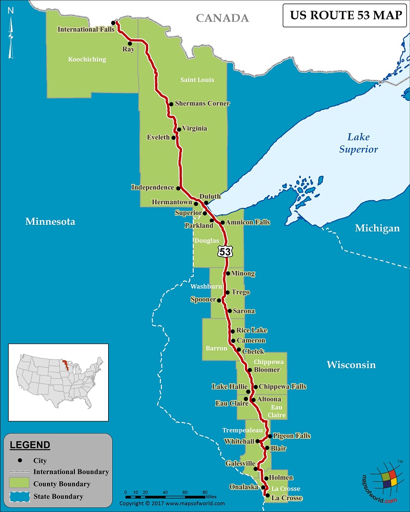
Description : US route 53 map showing the path of highway 53 with states and cities covered.
US Route 53
US Route 53 is a significant route of the US Numbered Highway System, and is a north-south US highway. Comprising a total length of 403 miles, US Route 53, traverses from La Crosse, Wisconsin to International Falls, Minnesota. Route 53 connects just two states – Wisconsin and Minnesota. Some cities that the route passes through are Independence, Virginia, Eveleth, Hermantown, Minong, Sarona, Rice Lake, and others.
Route 53 serves as a link between I-94 in Eau Claire, Wisconsin, and the port city of Duluth, Minnesota. The section of the route in Wisconsin that runs between Eau Claire and the city of Superior, is a four-lane divided highway. The Minnesota portion of 53 is known as the ‘Voyageurs Highway.’ Some of the major junctions that connect US Route 53 are I-90, I-94, I-35, MN 33, and US 71.

