US Route 50 Map

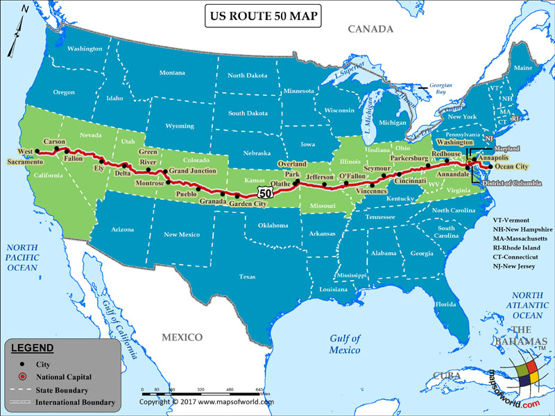
Description : US route 50 map showing the path of highway 50 with states and cities covered.
US Route 50
The US Route 50 is one of the most important routes of the US Highways system, traversing through 12 states, the District of Columbia, and hundreds of cities and rural areas. It has also been called ‘the loneliest road,’ due to its long, straight stretches. The more than 3,000 mile-long route starts in the Californian city of West Sacramento, and ends at Maryland's Ocean City. In between, it crosses the states of Nevada, Utah, Colorado, Kansas, Missouri, Illinois, Indiana, Ohio, West Virginia, and Virginia.
In the western United States, a major part of the route passes through mountains and deserts. This is where the road earns its nickname, 'loneliest road in the world.' It can get lonely while driving through this particular section in Nevada or Utah, as you’ll see miles of sand, mountains, sky.
While traversing through the Midwest, one can visit major cities such as St Louis, and Kansas City in Missouri, and Cincinnati in Ohio, as well as many rural areas. In the eastern United States, US Route 50 continues through the Appalachian Mountains in West Virginia. From here the route goes through the nation’s capital, Washington D.C., before it finally concludes in Ocean City, Maryland.
There are many attractions along this 3,000-mile long stretch – though in some cases one may have to take a detour - are the Great Basin National Park, Lake Tahoe, San Rafael Reef, Sevier Desert, Tallgrass Prairie National Preserve, to name a scant few. For city adventure along the way, you can stop in San Francisco, Sacramento, Pueblo, Jefferson City, St Louis, Kansas City, Ocean City, and of course, Washington D.C. The variety of attractions and cities along US Route 50, make a true ‘slice of America.’

