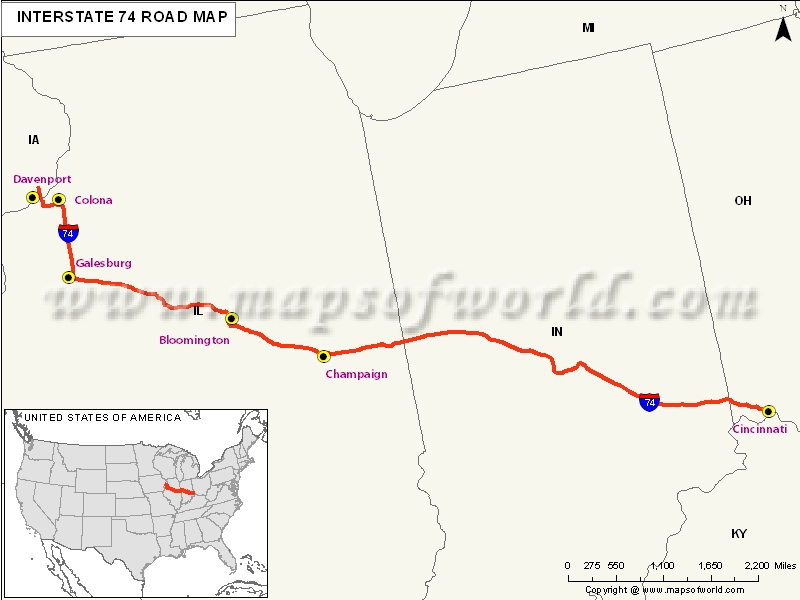
US Interstate 74 Map

Description : US Interstate 74 (I-74) Map showing routes from Davenport, IA to Cincinnati, Ohio
US Interstate 74 Highway Map
Interstate 74 exists in three areas of North Carolina, which include near Mount Airy; from Interstate 40 at Winston Salem south to Ellerbe; and, between Lumberton and Laurinburg.
Extent of I-74 Highway
I -74 starts from south to Interstate 80. In between, the areas that are covered, include Iowa, Illinois, Indiana, Ohio, North Carolina. In future, there are plans to extend it towards the south and middle-west.States and Cities Along I-74 Highway
- Vermillion: Highland Township
- Fountain: Covington, Veedersburg
- Montgomery: Wayne Township, Crawfordsville
- Boone: Jamestone
- Hendricks: Lizton, Middle Township, Brownsburg
- Marion: Indianapolis, Wanamaker, Acton, and many more to name.
Restaurants Along Interstate I-74 Highway
- Buffalo Wild Wings Grill and Bar
- Thara Thai Restaurant
- Red Lobster
- Big Grove Tavern
- Farren's, etc., to name amongst others.
Attractions Along I-74 Highway
- Fantasy Balloons
- Celebration River cruises
- Quad City Botanical Center
- Rock Island Arsenal
- Rock Island County Historical, to name a few.
Route of Interstate Highway No.74 |
|---|
| State | Entry Point | Exit Point | Length |
|---|---|---|---|
| Iowa | Davenport, IA | Mississippi River | 5.386 mi[2] (8.668 km) |
| Illinois | Moline, IL | Danville, IL | 220.34 mi[2] (354.60 km) |
| Indiana | Illinois state line | Ohio state line | 171.54 mi (276.07 km) |
| Ohio | Indiana state line | Cincinnati, OH | 19.47 mi (31.33 km) |
| North Carolina | (Interstate 74, broken in three segments across the state) Mount Airy, the Piedmont Triad and Laurinburg areas | 122.0 mi (196.3 km) |
US Interstates Highways Route Map |
|---|

