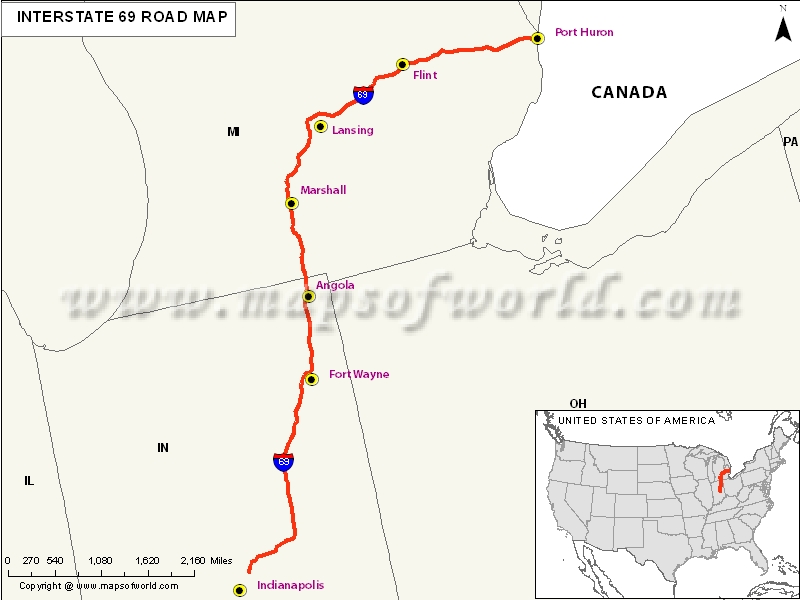
USA Interstate 69 Map

Description : Map depicts US Interstate 69 (I-69) route from Indianapolis, Indiana to Port Huron, Michigan.
US Interstate 69 Highway Map
Interstate 69, more popularly known as I-69, is basically an Interstate Highway in the United States. Its existence remains in two parts; a proposed extension of the southwest to the Mexican border in Texas, and the other one is the completed highway from Indianapolis, which is in the northeast to the Canadian border in Port Huron.
Extent of I-69 Highway
The extension of I-69 is also known as NAFTA superhighway. The reason for this is that of the help trade with the Canada and Mexico spurred by the North America Free Trade Agreement. It is a short piece in the northwestern Mississippi which was built and called as I-69.States and Cities Along I-69 Highway
North
Michigan: Coldwater, Battle Creek, Lansing, Flint, Port Huron
Indiana: Indianapolis, Anderson, Muncie, Fort Wayne
Restaurants Along Interstate I-69 Highway
Michigan:
- Empress of China Restaurant
- Outback Steakhouse
- Golden Moon
- Red robin, etc.
Indiana:
- Thai Taste
- Ichiban Noodles
- Loon Lake Lodge
- Golden Corral, etc.
Attractions Along I-69 Highway
Michigan:
- Greenstreet Arts
- Tour Connection Incorporated
- The Blue Water Traveler
Indiana:
- Art X Pression
- Fishers Chamber Players
- Science Central, etc.
Route of Interstate Highway No.69 |
|---|
| State | Entry Point | Exit Point | Length |
|---|---|---|---|
| Texas | Victoria, TX | Haslam, TX | 74.9 mi (120.5 km) |
| Texas state line, LA | Texas state line, LA | Arkansas state line, LA | 100 mi (161 km) |
| Louisiana state line, AR | Louisiana state line, AR | Mississippi state line, AR | 185 mi (298 km) |
| Mississippi | near Banks, MS | Tennessee state line in Southaven, MS | 23.390 mi (37.643 km) |
| Mississippi state line, TN | Mississippi state line, TN | Memphis, TN | 21.0 mi (33.8 km) |
| Tennessee border in Fulton, KY | Tennessee border in Fulton, KY | near Henderson, KY | 148.090 mi (238.328 km) |
| Indiana | Henderson, IN | Michigan state line, IN | 272.00 mi (437.74 km) |
| Michigan | Kinderhook Township, MI | Canadian border in Port Huron, MI | 202.317 mi (325.598 km) |
| Total Length | 820.2 mi (1,320.0 km) |
US Interstates Highways Route Map |
|---|

