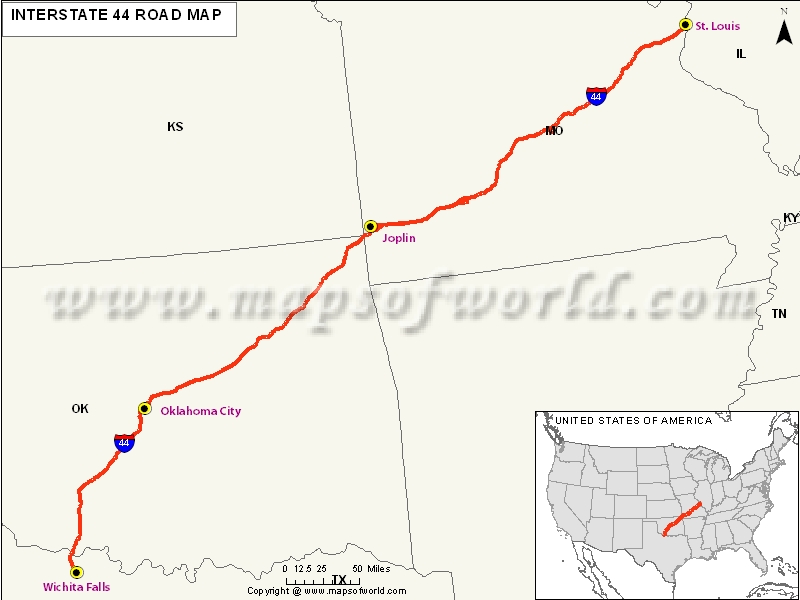
USA Interstate 44 Map

Description : The Map depicts US Interstate 44 (I-44) route from Wichita Falls, Texas to St. Louis, Missouri.
US Interstate 44 Highway Map
It is an important interstate highway in the Central United States. It is an east-west road because it has even number. It follows much of southwest and northeast alignment. Its western terminus is located in the Wichita Falls in Texas. Its eastern terminus is located at I-70 in St. Louis in Missouri
Extent of I-44 Highway
One of the major interstate highways that exists in the Central United States. This is basically called as an east-west road for the reason of its even number. The alignment followed for this is southwest and northeast. It has two terminus, eastern and western; eastern is in I-70, St. Louis, Missouri, whereas the western is at Wichita Falls, Texas. This is one of the interstates which have been built to bypass the U.S. Route 66. the section that is covered by this highway is that of St.Louis and Okhlahoma City.States and Cities Along I-44 Highway
- Texas
- Okhlahoma
- Missouri
Restaurants Along Interstate I-44 Highway
Texas:
- Circle H Bar-B-Que
- Sonic Drive-in
- Rainbow Restaurants
Okhlahoma:
- China Delight
- Tacoville
- Deep Fork Grille
Missouri:
- Sam's Steakhouse
- China Garden
- Gianino's Restaurant Bar
Attractions Along I-44 Highway
- Grant's Farm
- Meramec Vineyards
- Soulard, and many more.
Route of Interstate Highway No.44 |
|---|
| State | Entry Point | Exit Point | Length |
|---|---|---|---|
| Texas | Wichita Falls, TX | Burkburnett, TX | 14.77 mi (23.77 km) |
| Oklahoma | Walters, OK | Oklahoma-Missouri state line | 328.53 mi (528.72 km) |
| Missouri | Joplin, MO | City of St. Louis | 293.183 mi (471.832 km) |
| Total Length | 633.79 mi (1,019.99 km) |
US Interstates Highways Route Map |
|---|

