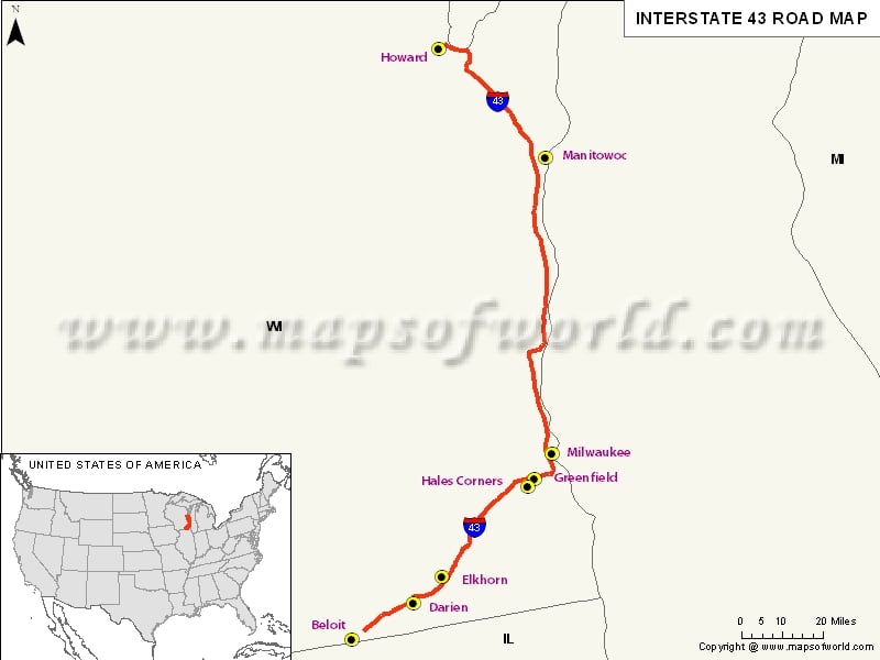
USA Interstate 43 Map
Description : Map depicts US Interstate 43 (I-43) route from Beloit, Wisconsin to Howard, Wisconsin.
US Interstate 43 Highway Map
Interstate 43 (I-43) is basically an intrastate highway, which is located completely in the state of Wisconsin, United States. This highway is the connection of Milwaukee with Green Bay, Manitowoc, Sheboygan and even point north. The route is also a connection between Elkhom and Beloit to that with Milwaukee.
Extent of I-43 Highway
There is an alternate route that I-43 has, within Shebogyan, Ozaukee and counties of Milwaukee for circumstances which require a road that closes, and starts at Good Hope Road. The former US 141 is mainly used.
States and Cities Along I-43 Highway
- Rock: Beloit, Town of Turtle, Town of Clinton
- Walworth: Town of Darien, Town of Lafayette, Town of East Troy, Elkhorn, East Troy
- Waukesha: Mukwonago, Big Bend, New Berlin, to name a few.
Restaurants Along Interstate I-43 Highway
- Figaro's Pizza
- Bamboo Garden Buffet LLC
- Peking House
- Atlanta Bread Company
- Lin's Garden
- Mayflower Restaurant Incorporated, etc.
Attractions Along I-43 Highway
- Fort Fun Amusements
- Kastle Carts
- Christ Church
- Bay Beach Wildlife Sanctuary
- Discover Green Bay, and many more.
Route of Interstate Highway No.43
|
| State |
Entry Point |
Exit Point |
Length |
| |
Beloit |
Howard |
191.55 mi (308.27 km) |
| Total Length |
|
|
191.55 mi (308.27 km) |


