Interstate 4 Map, USA

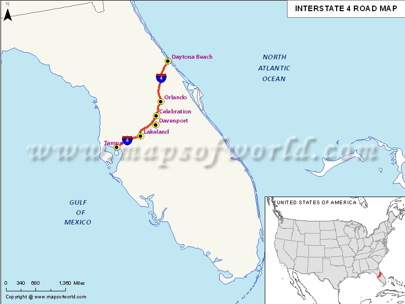
Description : Map depicts US Interstate 4 (I-4) route from Tampa, Florida to Daytona Beach, Florida.
US Interstate 4 highway Map
Interstate 4, popularly abbreviated as I-4 is a 132.298 mile long i.e. 212.913 km Interstate Highway situated in the US state of Florida. It is located along a southwest-northeast axis from the Interstate 275 in Tampa to the Interstate 95 at Daytona Beach. The entire of Interstate 4 overlaps the entire of State Road 400(SR 400), which further extends from Daytona Beach from the Interstate 95 to the US Highway 1. The Interstate 4 doesn’t have any auxiliary Interstate Highway spurs or loops. But, it definitely intersects multiple expressways, which have been designated as state roads.
Extent of I-4 Highway
Interstate 4 has its 132-mile-long western terminus is with an interchange with the Interstate 275, also known as Malfunction Junction, located near downtown Tampa. Towards the east of this Malfunction Junction, the Interstate 4 passes along the north side of Tampa’s Ybor City district. This Interstate continues east past the Florida State Fairgrounds towards the turbine interchange with the Interstate 75.States and cities along I-4 Highway
- Florida: Deltona, Kissimmee, Lakeland, Orlando, Tampa- St. Petersburg
Restaurants along Interstate-4 Highway
Here is a list of few great restaurants along Interstate-4 Highway:
- Bernini
- Far East Chinese Restaurant
- Soul of Korea
- Chan’s Chinese Restaurant
- El Paraiso Cafe
Attractions along I-4 Highway
Some of the renowned tourist attractions along I-4 Highway include:
- Gameworks
- Ben-Zs Galerie
- Hoffman Porges Art Gallery
- Centro Asturiano De Tampa
- Ybor City State Museum
Route of Interstate Highway No.4 |
|---|
| State | Entry Point | Exit Point | Length |
|---|---|---|---|
| Florida | Tampa, FL | Daytona Beach, FL | 132.298 mi (212.913 km) |
| Total Length | 132.298 mi (212.913 km) |
US Interstates Highways Route Map |
|---|

