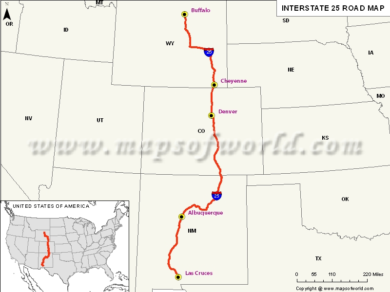
USA Interstate 25 Map

Description : Map depicts US Interstate 25 (I-25) route from Las Cruces, New Mexico to Buffalo, Wyoming.
Interstate 25
Interstate 25, which is popularly known as I-25, is a prominent Interstate Highway in western United States. The highway runs from the state of New Mexico to Wyoming. It provides scenic views of the Rocky Mountains. Some of the prominent military and air bases that lie along the route include Peterson Air Force Base, Buckley Air Force Base, Fort Carson, Cheyenne Mountain Complex headquarters of NORAD, the United States Air Force Academy.
Extent
Mainly a north-south highway, the northern end of I-25 is at Las Cruces in New Mexico and the southern end at Buffalo in Wyoming. The Intterstate-25 is known as the Valley Highway in Denver, while the section in El Paso County is called the Ronald Reagan Highway. It is named the John F Kennedy Memorial Highway through Pueblo.States and cities along I-25
- Wyoming : Cheyenne, Casper, and Sheridan
- Colorado : Pueblo, Colorado Springs, Denver, and Fort Collins
- New Mexico : Las Cruces, Albuquerque, Santa Fe, Las Vegas, Raton
Restaurants along Interstate-25 Highway
- New Mexico : Shems Restaurant in Las Cruces, China Garden Restaurant in Raton, Standard Diner in Albuquerque, Arby’s in Las Cruces, Casa Chaco Restaurant in Albuquerque, Blue Moon in Ls Cruces to name a few.
- Colorado : Jerusalem Restaurant in Denver, Tequilla’s in Santa Fe, C & H Restaurant in Trinidad, Joe Jose’s Bistro in Aguilar, Huerfano Diner in Walsenburg etc.
- Wyoming : Senator’s Restaurant in Cheyenne, Stampede Steakhouse in Chugwater, Arby’s in Wheatland and Orin Junction Truck Stop in Douglas.
Attractions along I-25
Some prominent tourist attractions that lie along the I-25 include - Edness Kimball Wilkins State Park, Cheyenne Botanic Gardens, Castlewood Canyon State Park, Trinidad Lake State Park, Fort Union National Monument, Petroglyph National Monument, and Elephant Butte Lake State Park.
Route of Interstate Highway No.25 |
|---|
| State | Entry Point | Exit Point | Length |
|---|---|---|---|
| New Mexico | Las Cruces, NM | Raton, New Mexico-Colorado line | 462.12 mi (743.72 km) |
| Colorado-New Mexico line | Colorado-New Mexico line | Wellington, CO | 305.040 mi (490.914 km) |
| Wyoming | Cheyenne, WY | Buffalo, WY | 300.53 mi (483.66 km) |
| Total Length | 1,062.77 mi (1,710.36 km) |
US Interstates Highways Route Map |
|---|

