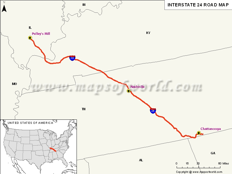
USA Interstate 24 Map

Description : The Map depicts US Interstate 24 (I-24) route from Pulley's Mill, Illinois to Chattanooga, Tennessee.
US Interstate 24 highway Map
Interstate 24, popularly abbreviated as I-24 is the Interstate Highway in the Midwestern and Southeastern United States. Since it’s an even-numbered interstate, it has been signed as an east-west route, which further follows a southeast-northwest routing.
I-24 has a diagonal routing and an unusual numbering simply because it doesn’t adhere to the US Interstate Highway System numbering conventions. A majority of high-traffic corridor between St. Louis, Missouri and Atlanta has been made up by Interstate 24.
Extent of I-24 Highway
The Interstate 24 stretches from Interstate 57, which is 10 miles south of Marion, Illinois to Chattanooga, Tennessee at the Interstate 75. In the US state of Illinois, Interstate 24 is a four-lane freeway that stretches through southern Illinois and the Shawnee National Forest. Out of five mainline exists of Interstate 24, only four have services.I-24 crosses into Kentucky through the Interstate 24 Bridge from Metropolis, Illinois to Paducah, Kentucky. Moreover, in the US state of Tennessee, the Interstate 24 stretches from Clarksville to Chattanooga via Nashville.
States and cities along I-24 Highway
- Tennessee : Chattanooga, Clarksville, Murfreesboro, Nashville-Davidson
Restaurants along Interstate-24 Highway
Here is a list of few great restaurants along Interstate-24 Highway:- Old Home Place
- Late Bloomers
- McDonald’s
- Dolly’s Place
- Shawnee Grill
Attractions along I-24 Highway
Some of the renowned tourist attractions along I-24 Highway include:
- Ferne Clyffe State Park
- Dunbar Cave State Park
- Chickamauga and Chattanooga National Military Park
Route of Interstate Highway No.24 |
|---|
| State | Entry Point | Exit Point | Length |
|---|---|---|---|
| 38.73 mi (62.33 km) | |||
| Kentucky | Paducah, KY | Oak Grove, KY | 93.37 mi (150.26 km) |
| Tennessee | Clarksville, TN | Chattanooga, TN | 184.26 mi (296.54 km) |
| Total Length | 316.36 mi (509.13 km) |
US Interstates Highways Route Map |
|---|

