
The Falkland Islands road map shows the national highways, expressways, main roads, and streets network spread across the Falkland Islands with adjoining cities.
Falkland Islands Road Map
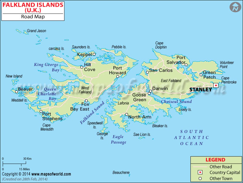
Description : Falkland Islands road map showing all the major roads, streets and highways.