
The Falkland Islands are an archipelago situated in the South Atlantic Ocean. The islands cover a total area of 4,700 square miles. As estimated in 2022, the population of the islands is 3,780.
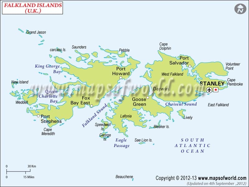
As shown in the Falkland Islands Political Map, the archipelago is located over 250 nautical miles east of the coast of mainland South America. The islands are made up of East Falkland, West Falkland, and more than 700 lesser islands.
The political map of the Falkland Islands shows the national capital, major cities, and other political divisions of the region. Goose Green, Fox Bay East, Hill Cove, and Port William are the major places in the archipelago.
Stanley is the capital of the island nation and is located in east Falkland.
Though the islands are a self-governing British Overseas Territory, defense and foreign affairs are looked after by the United Kingdom.
Port Stanley Airport is shown on the political map of the Falkland Islands.
| Division | Population: 2022 | Area(km.²) | Area(mi.²) |
|---|---|---|---|
| Falkland Islands | 3,780 | 12,200 | 4,700 |