
Britain’s Political Map helps the user in getting a clear idea about the various parts of Britain. The map shows international boundaries, the state boundaries with their capitals, national capital, and other important cities.
Political Map of Britain
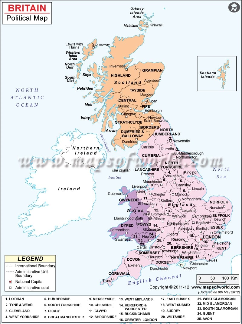
Description: Political map of Britain features the Scotland, England and Wales, adminstrative seats and national capital.