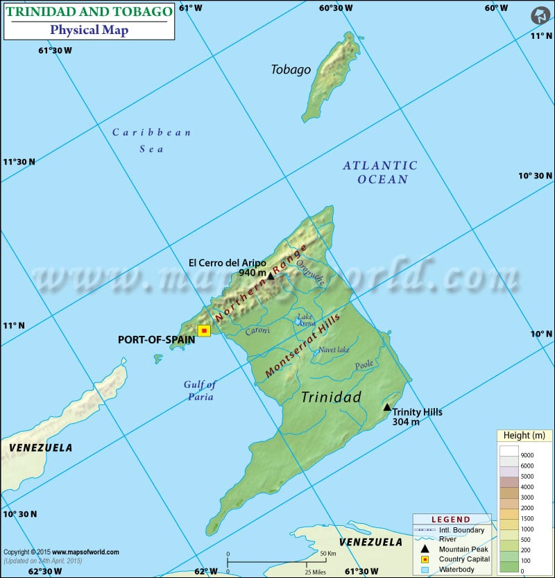
Physical map of Trinidad and Tobago shows geographical features of the country such as height from sea level, rivers, lakes, mountains, deserts, oceans, etc in different colors.

Physical map of Trinidad and Tobago shows geographical features of the country such as height from sea level, rivers, lakes, mountains, deserts, oceans, etc in different colors.
This website uses cookies to improve your experience. We'll assume you're ok with this, but you can opt-out if you wish. Read More