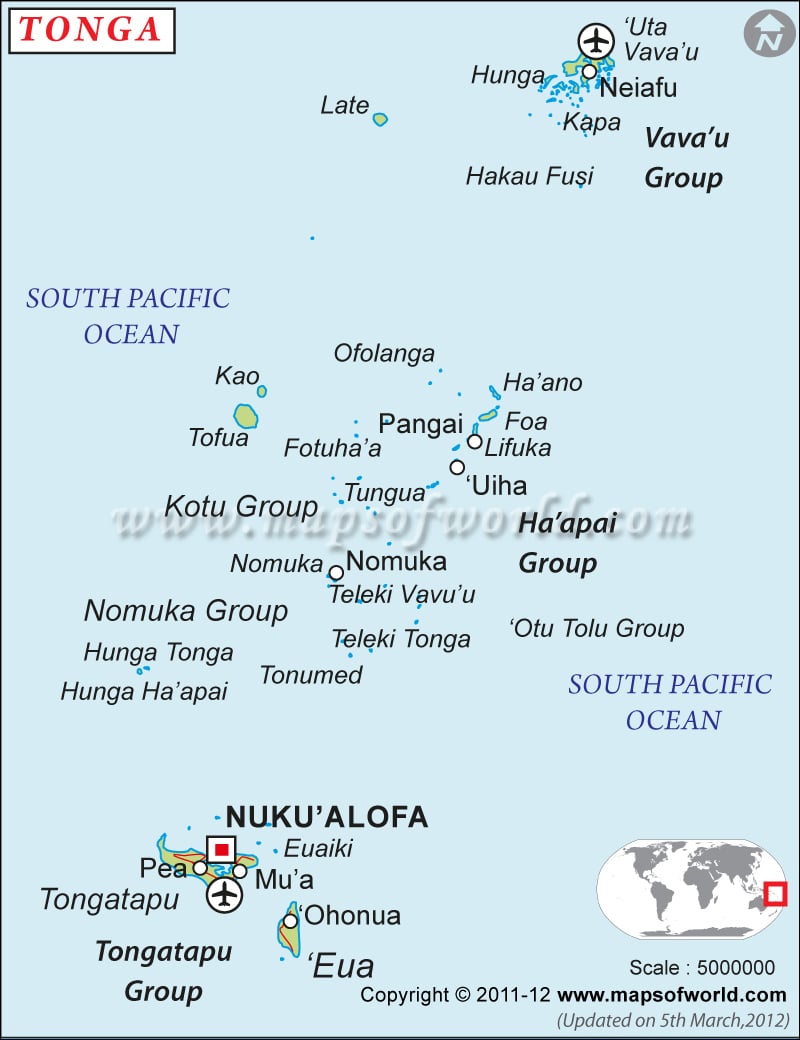
Political map of Tonga illustrates the surrounding countries with international borders, 3 island groups boundaries with their capitals and the national capital.

Description : Tonga Political map showing the international boundary, island groups boundaries with their capitals and national capital.
Political map of Tonga illustrates the surrounding countries with international borders, 3 island groups boundaries with their capitals and the national capital.
This website uses cookies to improve your experience. We'll assume you're ok with this, but you can opt-out if you wish. Read More